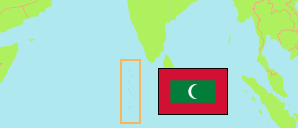
Maale'
City in Maldives
Contents: Subdivision
The population development in Maale' as well as related information and services (Wikipedia, Google, images).
| Name | Status | Native | Population Census 2014-09-20 | Population Census 2022-09-13 | |
|---|---|---|---|---|---|
| Maale' [Malé] | City | މާލެ | 153,904 | 211,908 | |
| Galolhu | City Division | ގަލޮޅު | 25,788 | 28,484 | → |
| Harbours (Maale, Hulhumaale & Vilimaale) | Industrial Areas | 2,431 | 1,399 | → | |
| Henveiru | City Division | ހެންވޭރު | 31,391 | 34,012 | → |
| Hulhule | Residential Island | ހުޅުލެ | 367 | 802 | → |
| Hulhumaale Phase 1 | City Division | ހުޅުމާލެ ސްޓޭޖް 1 | 17,149 | 35,859 | → |
| Hulhumaale Phase 2 | City Division | ހުޅުމާލެ ސްޓޭޖް 2 | ... | 29,855 | → |
| Maafannu | City Division | މާފަންނު | 42,788 | 47,036 | → |
| Machchangolhi | City Division | މައްޗަންގޮޅި | 26,002 | 27,706 | → |
| Vilin'gili [Vilimalé] | City Division | ވިލިނގިލި | 7,988 | 6,755 | → |
| Dhivehi Raajjeyge [Maldives] | Republic | ދިވެހިރާއްޖެ | 402,071 | 515,132 |
Source: National Bureau of Statistics, Republic of Maldives.
Explanation: Uninhabited islands are not listed.
Further information about the population structure:
| Gender (C 2022) | |
|---|---|
| Males | 124,894 |
| Females | 87,014 |
| Citizenship (C 2022) | |
|---|---|
| Maldives | 160,187 |
| Foreign Citizenship | 51,721 |