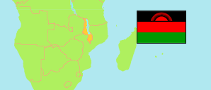
Mzimba
District in Malawi
Contents: Subdivision
The population in Mzimba as well as related information and services (Wikipedia, Google, images).
| Name | Status | Population Census 2018-09-03 | |
|---|---|---|---|
| Mzimba | District | 940,184 | |
| Chindi | Traditional Authority | 161,938 | → |
| Jaravikuba Munthali | Traditional Authority | 17,699 | → |
| Kampingo Sibande | Traditional Authority | 68,719 | → |
| Khosolo Gwaza Jere | Traditional Authority | 56,973 | → |
| Levi Jere | Traditional Authority | 18,793 | → |
| Mabulabo | Traditional Authority | 64,274 | → |
| M'Mbelwa | Traditional Authority | 128,656 | → |
| Mpherembe | Traditional Authority | 67,292 | → |
| Mtwalo | Traditional Authority | 191,108 | → |
| Mzikubola | Traditional Authority | 101,108 | → |
| Mzimba | Settlement | 26,096 | → |
| Mzukuzuku | Traditional Authority | 37,528 | → |
| Vwaza Marsh Reserve | Reserve | 0 | → |
| Malawi | Republic | 17,563,749 |
Source: National Statistical Office of Malawi.
Further information about the population structure:
| Age Groups (C 2018) | |
|---|---|
| 0-14 years | 418,786 |
| 15-64 years | 482,230 |
| 65+ years | 39,168 |
| Age Distribution (C 2018) | |
|---|---|
| 0-9 years | 279,702 |
| 10-19 years | 249,446 |
| 20-29 years | 145,925 |
| 30-39 years | 98,919 |
| 40-49 years | 66,450 |
| 50-59 years | 44,852 |
| 60-69 years | 28,899 |
| 70+ years | 25,991 |