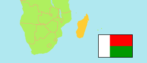
Manjakandriana
District in Madagascar
Contents: Population
The population development of Manjakandriana as well as related information and services (Wikipedia, Google, images).
| Name | Status | Population Census 1993-08-01 | Population Census 2018-06-01 | Population Projection 2020-06-01 | |
|---|---|---|---|---|---|
| Manjakandriana | District | 159,406 | 220,243 | 223,286 | |
| Madagascar | Republic | 12,238,914 | 25,674,196 | 27,190,927 |
Source: Institut National de la Statistique Madagascar (web).
Explanation: The 2018 figures are final. The enumeration took place from May 18 to June 25, 2018. The surface of districts is computed by using geospatial data.
Further information about the population structure:
| Gender (C 2018) | |
|---|---|
| Males | 109,641 |
| Females | 110,602 |
| Urbanization (C 2018) | |
|---|---|
| Rural | 198,055 |
| Urban | 22,188 |
