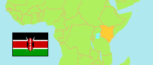
Baringo
County in Kenya
Contents: Subdivision
The population development in Baringo as well as related information and services (Wikipedia, Google, images).
| Name | Status | Population Census 2009-08-24 | Population Census 2019-08-24 | |
|---|---|---|---|---|
| Baringo | County | 555,561 | 666,763 | |
| Baringo Central | Subcounty | 89,174 | 96,951 | → |
| Baringo North | Subcounty | 93,789 | 104,871 | → |
| East Pokot | Subcounty | 57,740 | 79,923 | → |
| Koibatek | Subcounty | 105,273 | 129,535 | → |
| Marigat (incl. Lake Baringo) | Subcounty | 74,413 | 90,958 | → |
| Mogotio | Subcounty | 60,959 | 91,104 | → |
| Tiaty East | Subcounty | 74,213 | 73,421 | → |
| Kenya | Republic | 38,610,097 | 47,564,296 |
Source: Kenya National Bureau of Statistics.
Further information about the population structure:
| Gender (C 2019) | |
|---|---|
| Males | 336,322 |
| Females | 330,428 |
| Intersex | 13 |
| Age Groups (C 2019) | |
|---|---|
| 0-14 years | 296,178 |
| 15-64 years | 344,824 |
| 65+ years | 25,746 |
| Age Distribution (C 2019) | |
|---|---|
| 90+ years | 1,304 |
| 80-89 years | 4,341 |
| 70-79 years | 11,203 |
| 60-69 years | 20,129 |
| 50-59 years | 28,966 |
| 40-49 years | 46,011 |
| 30-39 years | 68,565 |
| 20-29 years | 109,103 |
| 10-19 years | 182,540 |
| 0-9 years | 194,586 |
