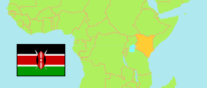
Meru
County in Kenya
Contents: Subdivision
The population development in Meru as well as related information and services (Wikipedia, Google, images).
| Name | Status | Population Census 2009-08-24 | Population Census 2019-08-24 | |
|---|---|---|---|---|
| Meru | County | 1,356,301 | 1,545,714 | |
| Buuri East | Subcounty | 69,929 | 76,598 | → |
| Buuri West | Subcounty | 59,201 | 80,762 | → |
| Igembe Central | Subcounty | 192,948 | 221,412 | → |
| Igembe North | Subcounty | 154,814 | 169,317 | → |
| Igembe South | Subcounty | 134,550 | 161,646 | → |
| Imenti North | Subcounty | 149,144 | 177,567 | → |
| Imenti South | Subcounty | 179,604 | 206,506 | → |
| Meru Central | Subcounty | 116,847 | 133,818 | → |
| Meru National Park | National Park | 444 | 385 | → |
| Mount Kenya National Park | National Park | 5,594 | 463 | → |
| Tigania Central | Subcounty | 93,970 | 104,730 | → |
| Tigania East | Subcounty | 70,319 | 72,549 | → |
| Tigania West | Subcounty | 128,937 | 139,961 | → |
| Kenya | Republic | 38,610,097 | 47,564,296 |
Source: Kenya National Bureau of Statistics.
Further information about the population structure:
| Gender (C 2019) | |
|---|---|
| Males | 767,698 |
| Females | 777,975 |
| Intersex | 41 |
| Age Groups (C 2019) | |
|---|---|
| 0-14 years | 540,234 |
| 15-64 years | 918,702 |
| 65+ years | 86,707 |
| Age Distribution (C 2019) | |
|---|---|
| 90+ years | 5,350 |
| 80-89 years | 15,271 |
| 70-79 years | 36,646 |
| 60-69 years | 65,378 |
| 50-59 years | 94,100 |
| 40-49 years | 157,007 |
| 30-39 years | 221,466 |
| 20-29 years | 244,940 |
| 10-19 years | 360,173 |
| 0-9 years | 345,312 |