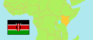
Taita-Taveta
County in Kenya
Contents: Subdivision
The population development in Taita-Taveta as well as related information and services (Wikipedia, Google, images).
| Name | Status | Population Census 2009-08-24 | Population Census 2019-08-24 | |
|---|---|---|---|---|
| Taita-Taveta | County | 284,657 | 340,671 | |
| Mwatate | Subcounty | 69,557 | 81,659 | → |
| Taita | Subcounty | 56,021 | 55,959 | → |
| Taveta | Subcounty | 67,665 | 91,222 | → |
| Voi | Subcounty | 91,414 | 111,831 | → |
| Kenya | Republic | 38,610,097 | 47,564,296 |
Source: Kenya National Bureau of Statistics.
Further information about the population structure:
| Gender (C 2019) | |
|---|---|
| Males | 173,337 |
| Females | 167,327 |
| Intersex | 7 |
| Age Groups (C 2019) | |
|---|---|
| 0-14 years | 115,882 |
| 15-64 years | 205,050 |
| 65+ years | 19,729 |
| Age Distribution (C 2019) | |
|---|---|
| 90+ years | 895 |
| 80-89 years | 3,427 |
| 70-79 years | 8,180 |
| 60-69 years | 16,304 |
| 50-59 years | 23,881 |
| 40-49 years | 35,196 |
| 30-39 years | 46,698 |
| 20-29 years | 55,372 |
| 10-19 years | 74,656 |
| 0-9 years | 76,052 |