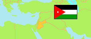
Ar-Ruwayshid
District in Mafraq Governorate
District
The population development of Ar-Ruwayshid.
| Name | Native | Status | Population Census 1994-12-10 | Population Census 2004-10-02 | Population Census 2015-11-30 | |
|---|---|---|---|---|---|---|
| Ar-Ruwayshid [Rwaished] | الرويشد | District | 10,032 | 9,805 | 7,490 | → |
| Al-Mafraq [Mafraq] | المفرق | Governorate | 178,914 | 244,188 | 549,948 |
Contents: Localities
The population development of the localities in Ar-Ruwayshid.
| Name | Native | Status | District | Population Census 1994-12-10 | Population Census 2004-10-02 | Population Census 2015-11-30 | |
|---|---|---|---|---|---|---|---|
| Al-Fayḍah [Fhaidhah] | الفيضة | Rural Locality | Ar-Ruwayshid | 90 | ... | 53 | → |
| Ar-Rawḍah [Rodah, Roadhet Bndan] | الروضة; روضة البندان | Rural Locality | Ar-Ruwayshid | ... | ... | 50 | → |
| Ar-Ruwayshid [Rwaished] | الرويشد | Urban Locality | Ar-Ruwayshid | 3,084 | ... | 5,731 | → |
| Jisr ar-Rwaīshad [Jeser Rwaished] | جسر الرويشد | Rural Locality | Ar-Ruwayshid | 188 | ... | 77 | → |
| Manshiyat al-Ghayyāth [Manshiyyet El-Gheiath] | منشية الغياث | Rural Locality | Ar-Ruwayshid | 1,109 | ... | 1,501 | → |
| Ṣālḥīat an-N'īm [Salheiat Enneim] | صالحية النعيم | Rural Locality | Ar-Ruwayshid | 201 | ... | 78 | → |
Source: Department of Statistics, Jordan (web).
Explanation: Area and density figures are computed using geospatial data.