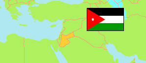
Al-Karak
Governorate in Jordan
Contents: Subdivision
The population development in Al-Karak as well as related information and services (Wikipedia, Google, images).
| Name | Status | Native | Population Census 1994-12-10 | Population Census 2004-10-02 | Population Census 2015-11-30 | |
|---|---|---|---|---|---|---|
| Al-Karak [Karak] | Governorate | الكرك | 169,770 | 204,185 | 316,629 | |
| Al-Āghwār al-Janūbī [Aghwar Janoobiyah] | District | الاغوار الجنوبية | ... | 32,446 | 54,867 | → |
| Al-Mazār al-Janūbī [Mazar Janoobee] | District | المزار الجنوبي | 42,248 | 57,191 | 95,124 | → |
| Al-Qaṣr [Qasr] | District | القصر | 16,587 | 20,860 | 29,407 | → |
| Al-Qaṭrānah [Qatraneh] | District | القطرانة | ... | 6,949 | 10,896 | → |
| 'Ayy [Ayy] | District | عي | ... | 9,711 | 8,152 | → |
| Faqū' [Faqo'e] | District | فقوع | 10,084 | 12,178 | 16,806 | → |
| Qaṣabah al-Karak [Kerak Qasabah] | District | قصبة الكرك | ... | 64,850 | 101,377 | → |
| Al-Urdunn [Jordan] | Kingdom | الأُرْدُنّ | 4,139,458 | 5,103,639 | 9,531,712 |
Source: Department of Statistics, Jordan (web).
Explanation: Area and density figures of districts are computed using geospatial data.