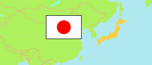
Kumamoto
Prefecture in Japan
Contents: Subdivision
The population development in Kumamoto as well as related information and services (Wikipedia, Google, images).
| Name | Status | Native | Population Census 1995-10-01 | Population Census 2000-10-01 | Population Census 2005-10-01 | Population Census 2010-10-01 | Population Census 2015-10-01 | Population Census 2020-10-01 | |
|---|---|---|---|---|---|---|---|---|---|
| Kumamoto | Prefecture | 熊本県 | 1,859,793 | 1,859,344 | 1,842,233 | 1,817,426 | 1,786,170 | 1,738,301 | |
| Amakusa | City (-shi) | 天草市 | 107,823 | 102,907 | 96,473 | 89,065 | 82,739 | 75,783 | → |
| Amakusa | District (-gun) | 天草郡 | 9,613 | 9,436 | 8,927 | 8,314 | 7,739 | 7,114 | → |
| Arao | City (-shi) | 荒尾市 | 57,389 | 56,905 | 55,960 | 55,321 | 53,407 | 50,832 | → |
| Ashikita | District (-gun) | 葦北郡 | 29,537 | 28,114 | 26,264 | 24,378 | 22,334 | 19,935 | → |
| Aso | City (-shi) | 阿蘇市 | 31,364 | 30,457 | 29,636 | 28,444 | 27,018 | 24,930 | → |
| Aso | District (-gun) | 阿蘇郡 | 41,827 | 40,899 | 40,703 | 39,392 | 37,375 | 33,773 | → |
| Hitoyoshi | City (-shi) | 人吉市 | 39,373 | 38,814 | 37,583 | 35,611 | 33,880 | 31,108 | → |
| Kamiamakusa | City (-shi) | 上天草市 | 36,667 | 35,314 | 32,502 | 29,902 | 27,006 | 24,563 | → |
| Kamimashiki | District (-gun) | 上益城郡 | 90,967 | 91,182 | 89,755 | 87,402 | 85,768 | 81,995 | → |
| Kikuchi | City (-shi) | 菊池市 | 52,545 | 52,636 | 51,862 | 50,194 | 48,167 | 46,416 | → |
| Kikuchi | District (-gun) | 菊池郡 | 52,649 | 56,381 | 61,541 | 68,968 | 74,436 | 78,524 | → |
| Kōshi | City (-shi) | 合志市 | 46,925 | 49,391 | 51,647 | 55,002 | 58,370 | 61,772 | → |
| Kuma | District (-gun) | 球磨郡 | 68,824 | 65,883 | 63,111 | 59,116 | 54,940 | 50,372 | → |
| Kumamoto | City (-shi) | 熊本市 | 708,097 | 720,816 | 727,978 | 734,474 | 740,822 | 738,865 | → |
| Minamata | City (-shi) | 水俣市 | 32,842 | 31,147 | 29,120 | 26,978 | 25,411 | 23,557 | → |
| Shimomashiki | District (-gun) | 下益城郡 | 13,594 | 12,969 | 12,254 | 11,388 | 10,333 | 9,392 | → |
| Tamana | City (-shi) | 玉名市 | 72,900 | 73,051 | 71,851 | 69,541 | 66,782 | 64,292 | → |
| Tamana | District (-gun) | 玉名郡 | 48,849 | 47,948 | 46,110 | 43,959 | 41,131 | 38,738 | → |
| Uki | City (-shi) | 宇城市 | 64,008 | 63,968 | 63,089 | 61,878 | 59,756 | 57,032 | → |
| Uto | City (-shi) | 宇土市 | 35,010 | 37,255 | 38,023 | 37,727 | 37,026 | 36,122 | → |
| Yamaga | City (-shi) | 山鹿市 | 60,991 | 59,491 | 57,726 | 55,391 | 52,264 | 49,025 | → |
| Yatsushiro | City (-shi) | 八代市 | 143,712 | 140,655 | 136,886 | 132,266 | 127,472 | 123,067 | → |
| Yatsushiro | District (-gun) | 八代郡 | 14,287 | 13,725 | 13,232 | 12,715 | 11,994 | 11,094 | → |
| Nippon [Japan] | State | 日本国 | 125,570,246 | 126,925,843 | 127,767,994 | 128,057,352 | 127,094,745 | 126,146,099 |
Source: Statistics Bureau Japan (web).
Further information about the population structure:
| Gender (C 2020) | |
|---|---|
| Males | 822,481 |
| Females | 915,820 |
| Age Groups (C 2020) | |
|---|---|
| 0-17 years | 279,022 |
| 18-64 years | 893,542 |
| 65+ years | 540,538 |
| Age Distribution (C 2020) | |
|---|---|
| 90+ years | 45,534 |
| 80-89 years | 144,318 |
| 70-79 years | 220,922 |
| 60-69 years | 245,828 |
| 50-59 years | 208,385 |
| 40-49 years | 218,718 |
| 30-39 years | 180,070 |
| 20-29 years | 141,590 |
| 10-19 years | 160,153 |
| 0-9 years | 147,584 |
| Citizenship (C 2020) | |
|---|---|
| Japan | 1,705,205 |
| Foreign Citizenship | 14,591 |
