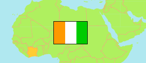
Béré
Region in Ivory Coast
Contents: Subdivision
The population development in Béré as well as related information and services (Wikipedia, Google, images).
| Name | Status | Population Census 2014-05-15 | Population Census 2021-12-14 | |
|---|---|---|---|---|
| Béré (Koyadougou) | Region | 389,758 | 492,151 | |
| Bouandougou | Sub-Prefecture | 35,671 | 45,494 | → |
| Dianra | Sub-Prefecture | 53,700 | 61,527 | → |
| Dianra-Village | Sub-Prefecture | 42,879 | 57,619 | → |
| Kongasso | Sub-Prefecture | 35,642 | 37,281 | → |
| Kounahiri | Sub-Prefecture | 42,037 | 63,830 | → |
| Mankono | Sub-Prefecture | 64,330 | 74,165 | → |
| Marandallah | Sub-Prefecture | 36,074 | 42,729 | → |
| Sarhala | Sub-Prefecture | 38,207 | 42,450 | → |
| Tiéningboué | Sub-Prefecture | 41,218 | 67,055 | → |
| Côte d'Ivoire [Ivory Coast] | Republic | 22,671,331 | 29,389,150 |
Source: Institut National de la Statistique, Republique de Côte d'Ivoire (web).
Explanation: Area figures are derived from geospatial data.