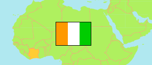
Zaranou
Sub-Prefecture in Comoé District
Sub-Prefecture
The population of Zaranou.
| Name | Status | Population Census 2014-05-15 | |
|---|---|---|---|
| Zaranou | Sub-Prefecture | 33,539 | → |
| Comoé | District | 1,203,052 |
Contents: Localities
The population of the localities in Zaranou.
| Name | Status | Sub-Prefecture | Population Census 2014-05-15 | |
|---|---|---|---|---|
| Bébou | Locality | Zaranou | 5,035 | → |
| Blékoum | Locality | Zaranou | 3,472 | → |
| Bokakokoré | Locality | Zaranou | 3,001 | → |
| Ehuasso Allangouanou | Locality | Zaranou | 4,436 | → |
| Manfia | Locality | Zaranou | 387 | → |
| M'Basso Agni | Locality | Zaranou | 2,184 | → |
| N'Gouanda Kouadiokro | Locality | Zaranou | 2,552 | → |
| Prakro | Locality | Zaranou | 1,208 | → |
| Soukou-Soukou | Locality | Zaranou | 1,917 | → |
| Zaranou | Locality | Zaranou | 9,347 | → |
Source: Institut National de la Statistique, Republique de Côte d'Ivoire (web).
Explanation: Area figures of sub-prefectures are derived from geospatial data.