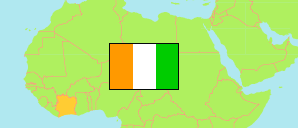
Gontougo
Region in Ivory Coast
Contents: Subdivision
The population development in Gontougo as well as related information and services (Wikipedia, Google, images).
| Name | Status | Population Census 1998-12-20 | Population Census 2014-05-15 | Population Census 2021-12-14 | |
|---|---|---|---|---|---|
| Gontougo | Region | 520,946 | 667,185 | 917,828 | |
| Bondoukou | Department | 240,913 | 333,707 | 453,841 | → |
| Koun-Fao | Department | 104,442 | 116,230 | 167,881 | → |
| Sandégué | Department | 51,213 | 56,215 | 69,742 | → |
| Tanda | Department | 63,055 | 77,555 | 113,523 | → |
| Transua | Department | 61,323 | 83,478 | 112,842 | → |
| Côte d'Ivoire [Ivory Coast] | Republic | 15,366,672 | 22,671,331 | 29,389,150 |
Source: Institut National de la Statistique, Republique de Côte d'Ivoire (web).
Explanation: Area figures are derived from geospatial data.