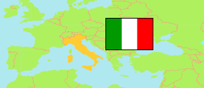
Peri
in Verona (Venetia)
Contents: Locality
The population development of Peri as well as related information and services (weather, Wikipedia, Google, images).
| Name | Province | Population Census 1991-10-20 | Population Census 2001-10-21 | Population Census 2011-10-09 | Population Census 2021-12-31 | |
|---|---|---|---|---|---|---|
| Peri | Verona | 383 | 386 | 465 | 525 | → |
Source: Istituto Nazionale di Statistica Italia.
Explanation: Localities according to the final 2021 definition; they are limited by unbuilt areas and boundaries of communes. The 2021 figures are result of a sampling survey combined with an evaluation of registers. They are aggregated from census sectors in 2011 boundaries. Area figures are derived from geospatial data.
Further information about the population structure:
| Gender (C 2021) | |
|---|---|
| Males | 259 |
| Females | 266 |
| Age Groups (C 2021) | |
|---|---|
| 0-14 years | 82 |
| 15-64 years | 344 |
| 65+ years | 99 |
| Age Distribution (C 2021) | |
|---|---|
| 70+ years | 70 |
| 60-69 years | 79 |
| 50-59 years | 68 |
| 40-49 years | 75 |
| 30-39 years | 60 |
| 20-29 years | 62 |
| 10-19 years | 53 |
| 0-9 years | 58 |
| Citizenship (C 2021) | |
|---|---|
| Italy | 413 |
| European Union | 37 |
| Other Citizenship | 75 |