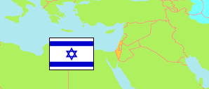
Kefar Shemaryahu
Rural Locality (jewish) in Tel Aviv Metropolitan Area (Gush Dan)
Contents: Subdivision
The population development in Kefar Shemaryahu as well as related information and services (Wikipedia, Google, images).
| Name | Status | Native | Population Estimate 2013-12-31 | Population Estimate 2017-12-31 | Population Estimate 2021-12-31 | |
|---|---|---|---|---|---|---|
| Kefar Shemaryahu [Kfar Shmaryahu] | Rural Locality (jewish) | כפר שמריהו | 1,799 | 1,872 | 1,948 | |
| Kefar Shemaryahu 0001 | Residential Area (jewish) | כפר שמריהו 0001 | 1,799 | 1,872 | 1,948 | → |
| Tel Aviv [Gush Dan] | Metropolitan Area | תל אביב (גוש דן) | 2,436,820 | 2,606,472 | 2,749,927 |
Source: Central Bureau of Statistics, The State of Israel.
Further information about the population structure:
| Gender (E 2021) | |
|---|---|
| Males | 944 |
| Females | 1,004 |
| Age Groups (E 2021) | |
|---|---|
| 0-14 years | 392 |
| 15-64 years | 1,118 |
| 65+ years | 436 |
| Age Distribution (E 2021) | |
|---|---|
| 80+ years | 135 |
| 70-79 years | 187 |
| 60-69 years | 226 |
| 50-59 years | 244 |
| 40-49 years | 232 |
| 30-39 years | 143 |
| 20-29 years | 224 |
| 10-19 years | 322 |
| 0-9 years | 233 |
| Ethnic Group (E 2021) | |
|---|---|
| Jews & Others | 1,931 |
| Arabs | 17 |