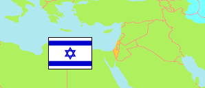
Hod HaSharon
City in Israel
Contents: Population
The population development of Hod HaSharon as well as related information and services (Wikipedia, Google, images).
| Name | Status | Native | Population Census 1983-06-04 | Population Census 1995-11-04 | Population Census 2008-12-27 | Population Estimate 2013-12-31 | Population Estimate 2021-12-31 | ||||||||||||
|---|---|---|---|---|---|---|---|---|---|---|---|---|---|---|---|---|---|---|---|
| Hod HaSharon | City | הוד השרון | 20,597 | 29,018 | 46,300 | 52,437 | 65,363 | ||||||||||||
Hod HaSharon 65,363 Population [2021] – Estimate 19.27 km² Area 3,392/km² Population Density [2021] 2.8% Annual Population Change [2013 → 2021] | |||||||||||||||||||
| Jisra'el [Israel] | State | ישראל | 4,037,400 | 5,643,500 | 7,412,200 | 8,134,500 | 9,452,975 | ||||||||||||
Source: Central Bureau of Statistics, The State of Israel.
Explanation: The population structure information does not consider people living outside of localities.
Further information about the population structure:
| Gender (E 2021) | |
|---|---|
| Males | 31,772 |
| Females | 33,591 |
| Age Groups (E 2021) | |
|---|---|
| 0-14 years | 16,230 |
| 15-64 years | 39,466 |
| 65+ years | 9,669 |
| Age Distribution (E 2021) | |
|---|---|
| 80+ years | 1,980 |
| 70-79 years | 4,622 |
| 60-69 years | 6,042 |
| 50-59 years | 7,573 |
| 40-49 years | 9,827 |
| 30-39 years | 7,227 |
| 20-29 years | 6,933 |
| 10-19 years | 10,498 |
| 0-9 years | 10,663 |
| Ethnic Group (E 2021) | |
|---|---|
| Jews | 63,847 |
| Arabs | 35 |
| Other ethnic group | 1,482 |
