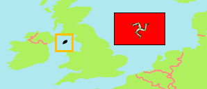
Ayre
Sheading in Isle of Man
Contents: Subdivision
The population development in Ayre as well as related information and services (Wikipedia, Google, images).
| Name | Status | Population Census 1981-04-05 | Population Census 1986-04-06 | Population Census 1996-04-14 | Population Census 2001-04-29 | Population Census 2006-04-23 | Population Census 2011-03-27 | Population Census 2016-04-24 | Population Census 2021-05-30 | |
|---|---|---|---|---|---|---|---|---|---|---|
| Ayre | Sheading | 2,994 | 2,855 | 2,596 | 2,694 | 3,036 | 3,110 | 3,055 | 2,989 | |
| Andreas | Parish | 1,113 | 1,115 | 1,144 | 1,152 | 1,381 | 1,428 | 1,397 | 1,400 | → |
| Bride | Parish | 413 | 378 | 405 | 408 | 418 | 400 | 382 | 359 | → |
| Lezayre | Parish | 1,468 | 1,362 | 1,047 | 1,134 | 1,237 | 1,282 | 1,276 | 1,230 | → |
| Isle of Man (Mannin) | Crown Dependency | 64,679 | 64,282 | 71,714 | 76,315 | 80,058 | 84,497 | 83,314 | 84,069 |
Source: Isle of Man Government (web), UN Demographic Yearbook.
Further information about the population structure:
| Gender (C 2021) | |
|---|---|
| Males | 1,515 |
| Females | 1,474 |
| Age Groups (C 2021) | |
|---|---|
| 0-14 years | 358 |
| 15-64 years | 1,789 |
| 65+ years | 842 |
| Age Distribution (C 2021) | |
|---|---|
| 0-9 years | 210 |
| 10-19 years | 305 |
| 20-29 years | 256 |
| 30-39 years | 213 |
| 40-49 years | 363 |
| 50-59 years | 547 |
| 60-69 years | 494 |
| 70-79 years | 389 |
| 80+ years | 212 |