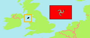
Isle of Man: Division
Contents: Areas
The population of sheadings and ancient parishes as well as of district-level towns and villages by census years.
| Name | Status | Population Census 1981-04-05 | Population Census 1986-04-06 | Population Census 1996-04-14 | Population Census 2001-04-29 | Population Census 2006-04-23 | Population Census 2011-03-27 | Population Census 2016-04-24 | Population Census 2021-05-30 | |
|---|---|---|---|---|---|---|---|---|---|---|
| Ayre | Sheading | 2,994 | 2,855 | 2,596 | 2,694 | 3,036 | 3,110 | 3,055 | 2,989 | → |
| Andreas | Parish | 1,113 | 1,115 | 1,144 | 1,152 | 1,381 | 1,428 | 1,397 | 1,400 | → |
| Bride | Parish | 413 | 378 | 405 | 408 | 418 | 400 | 382 | 359 | → |
| Lezayre | Parish | 1,468 | 1,362 | 1,047 | 1,134 | 1,237 | 1,282 | 1,276 | 1,230 | → |
| Garff | Sheading | 8,960 | 8,951 | 10,457 | 11,381 | 11,590 | 12,029 | 12,085 | 12,543 | → |
| Laxey [→ Garff District] | Village | 1,257 | 1,279 | 1,433 | 1,725 | 1,768 | 1,707 | 1,676 | 1,656 | → |
| Lonan [→ Garff District] | Parish | 1,126 | 1,139 | 1,292 | 1,393 | 1,563 | 1,533 | 1,579 | 1,647 | → |
| Maughold [→ Garff District] | Parish | 759 | 755 | 858 | 941 | 950 | 980 | 985 | 952 | → |
| Ramsey | Town | 5,818 | 5,778 | 6,874 | 7,322 | 7,309 | 7,809 | 7,845 | 8,288 | → |
| Glenfaba | Sheading | 5,794 | 5,755 | 6,055 | 6,100 | 6,569 | 7,647 | 7,916 | 8,253 | → |
| German | Parish | 1,029 | 1,051 | 1,038 | 1,010 | 995 | 1,024 | 966 | 1,056 | → |
| Patrick | Parish | 1,077 | 1,044 | 1,198 | 1,305 | 1,294 | 1,531 | 1,576 | 1,487 | → |
| Peel | Town | 3,688 | 3,660 | 3,819 | 3,785 | 4,280 | 5,092 | 5,374 | 5,710 | → |
| Michael | Sheading | 2,274 | 2,371 | 2,697 | 2,976 | 3,341 | 3,564 | 3,399 | 3,343 | → |
| Ballaugh | Parish | 681 | 745 | 812 | 868 | 1,042 | 1,042 | 1,032 | 1,041 | → |
| Jurby | Parish | 616 | 582 | 624 | 677 | 659 | 795 | 776 | 780 | → |
| Michael [→ Michael District] | Parish | 977 | 1,044 | 1,261 | 1,431 | 1,640 | 1,727 | 1,591 | 1,522 | → |
| Middle | Sheading | 32,060 | 31,829 | 36,656 | 39,274 | 41,307 | 43,800 | 42,692 | 42,089 | → |
| Braddan | Parish | 2,520 | 1,804 | 2,527 | 2,665 | 3,151 | 3,582 | 3,621 | 3,404 | → |
| Douglas | Town | 19,944 | 20,368 | 23,487 | 25,347 | 26,218 | 27,935 | 26,997 | 26,677 | → |
| Marown | Parish | 1,290 | 1,281 | 1,564 | 1,879 | 2,086 | 2,309 | 2,246 | 2,220 | → |
| Onchan | Village | 7,879 | 7,949 | 8,656 | 8,803 | 9,172 | 9,283 | 9,128 | 9,039 | → |
| Santon | Parish | 427 | 427 | 422 | 580 | 680 | 691 | 700 | 749 | → |
| Rushen | Sheading | 12,597 | 12,521 | 13,253 | 13,890 | 14,215 | 14,347 | 14,167 | 14,852 | → |
| Arbory | Parish | 1,651 | 1,610 | 1,622 | 1,714 | 1,723 | 1,750 | 1,847 | 1,899 | → |
| Castletown | Town | 3,141 | 3,019 | 2,958 | 3,100 | 3,109 | 3,093 | 3,216 | 3,206 | → |
| Malew | Parish | 2,080 | 2,054 | 2,140 | 2,262 | 2,304 | 2,387 | 2,167 | 2,367 | → |
| Port Erin | Village | 2,812 | 2,868 | 3,218 | 3,369 | 3,575 | 3,531 | 3,484 | 3,730 | → |
| Port St. Mary | Village | 1,572 | 1,610 | 1,874 | 1,941 | 1,913 | 1,957 | 1,916 | 1,989 | → |
| Rushen | Parish | 1,341 | 1,360 | 1,441 | 1,504 | 1,591 | 1,629 | 1,537 | 1,661 | → |
| Isle of Man (Mannin) | Crown Dependency | 64,679 | 64,282 | 71,714 | 76,315 | 80,058 | 84,497 | 83,314 | 84,069 |
Source: Isle of Man Government (web), UN Demographic Yearbook.
Further information about the population structure:
| Gender (C 2021) | |
|---|---|
| Males | 41,641 |
| Females | 42,428 |
| Age Groups (C 2021) | |
|---|---|
| 0-14 years | 12,514 |
| 15-64 years | 52,986 |
| 65+ years | 18,569 |
| Age Distribution (C 2021) | |
|---|---|
| 0-9 years | 7,728 |
| 10-19 years | 9,234 |
| 20-29 years | 8,673 |
| 30-39 years | 9,695 |
| 40-49 years | 11,040 |
| 50-59 years | 13,361 |
| 60-69 years | 10,667 |
| 70-79 years | 8,827 |
| 80+ years | 4,844 |