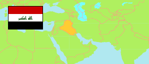
Maysān
Governorate in Iraq
Contents: Subdivision
The population development in Maysān as well as related information and services (Wikipedia, Google, images).
| Name | Status | Native | Population Estimate 2009-10-17 | Population Estimate 2018-07-01 | |
|---|---|---|---|---|---|
| Maysān | Governorate | ميسان | 922,890 | 1,112,673 | |
| Al-'Adil | Subdistrict | العدل | 17,957 | 21,719 | → |
| Al-'Amārah [Amara] | Central Subdistrict | العمارة | 459,216 | 562,187 | → |
| 'Alī al-Gharbī | Central Subdistrict | علي الغربي | 26,853 | 31,918 | → |
| 'Alī ash-Sharqī | Subdistrict | علي الشرقي | 17,850 | 21,225 | → |
| Al-Kaḥlā' | Central Subdistrict | الكحلاء | 32,689 | 38,927 | → |
| Al-Khayr | Subdistrict | الخیر | 20,723 | 24,301 | → |
| Al-Maīmūnah | Central Subdistrict | المیمونة | 44,429 | 52,149 | → |
| Al-Majar al-Kabīr | Central Subdistrict | المجر الكبير | 93,313 | 113,283 | → |
| Al-Musharaḥ | Subdistrict | المشرح | 26,158 | 30,790 | → |
| Al-'Uzaīr | Subdistrict | العزیر | 39,351 | 46,237 | → |
| As-Saīd 'Āḥmad ar-Rifā'aī | Subdistrict | السید أحمد الرفاعي | 12,245 | 14,090 | → |
| As-Salām | Subdistrict | السلام | 31,782 | 37,674 | → |
| Banī Hāshim | Subdistrict | بني ھاشم | 16,798 | 19,298 | → |
| Kumayt | Subdistrict | كمیت | 31,767 | 37,047 | → |
| Qal'at Ṣāliḥ / Madhar | Central Subdistrict | قلعة صالح | 51,759 | 61,828 | → |
| Al-'Irāq [Iraq] | Republic | 31,664,466 | 38,124,182 |
Source: Central Organization for Statistics and Information Technology (web).
Explanation: Area figures of subdistricts are computed by using geospatial data.