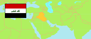
Ṣalāḥ ad-Dīn
Governorate in Iraq
Contents: Subdivision
The population development in Ṣalāḥ ad-Dīn as well as related information and services (Wikipedia, Google, images).
| Name | Status | Native | Population Estimate 2009-10-17 | Population Estimate 2018-07-01 | |
|---|---|---|---|---|---|
| Ṣalāḥ ad-Dīn [Saladin] | Governorate | صلاح الدين | 1,337,786 | 1,595,235 | |
| Ad-Dawr | Central Subdistrict | الدور | 59,840 | 71,027 | → |
| Ad-Dujaīl | Central Subdistrict | الدجیل | 92,387 | 109,697 | → |
| Aḍ-Ḍulū'īah | Subdistrict | الضلوعیة | 57,589 | 68,215 | → |
| Al-'Alam | Subdistrict | العلم | 50,714 | 59,935 | → |
| Al-'Isḥāqī | Subdistrict | الإسحاقي | 41,821 | 49,228 | → |
| Al-Mu'taṣam | Subdistrict | المعتصم | 15,393 | 18,336 | → |
| Āmirlī | Subdistrict | آمرلي | 39,087 | 46,360 | → |
| Ash-Shirqāṭ | Central Subdistrict | الشرقاط | 183,504 | 217,269 | → |
| Aṣ-Ṣaynīah | Subdistrict | الصینیة | 32,348 | 39,102 | → |
| Baījī | Central Subdistrict | بیجي | 153,082 | 182,564 | → |
| Balad | Central Subdistrict | بلد | 68,700 | 82,731 | → |
| Dijlah | Subdistrict | دجلة | 15,649 | 18,427 | → |
| Sāmarrā' | Central Subdistrict | سامراء | 175,575 | 211,136 | → |
| Sulaīmān Bik | Subdistrict | سلیمان بك | 23,660 | 28,255 | → |
| Tikrīt | Central Subdistrict | تكريت | 158,503 | 189,841 | → |
| Ṭūz Khūrmātū | Central Subdistrict | طوز خورماتو | 100,964 | 122,094 | → |
| Yathrib | Subdistrict | یثرب | 68,970 | 81,018 | → |
| Al-'Irāq [Iraq] | Republic | 31,664,466 | 38,124,182 |
Source: Central Organization for Statistics and Information Technology (web).
Explanation: Area figures of subdistricts are computed by using geospatial data.