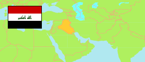
Bābil
Governorate in Iraq
Contents: Subdivision
The population development in Bābil as well as related information and services (Wikipedia, Google, images).
| Name | Status | Native | Population Estimate 2009-10-17 | Population Estimate 2018-07-01 | |
|---|---|---|---|---|---|
| Bābil [Babylon] | Governorate | بابل | 1,729,666 | 2,065,042 | |
| Abī Gharaq | Subdistrict | أبي غرق | 95,849 | 113,162 | → |
| Al-Hāshmiyah | Central Subdistrict | الھاشمیة | 30,511 | 37,273 | → |
| Al-Ḥillah [Hillah] | Central Subdistrict | الحلة | 481,096 | 582,046 | → |
| Al-Imām | Subdistrict | الامام | 32,383 | 38,417 | → |
| Al-Iskandrīah | Subdistrict | الاسكندریة | 138,244 | 165,946 | → |
| Al-Kifl | Subdistrict | الكفل | 124,096 | 146,068 | → |
| Al-Madḥatiyah | Subdistrict | المدحتية | 118,858 | 141,515 | → |
| Al-Maḥāwīl | Central Subdistrict | المحاویل | 103,003 | 121,763 | → |
| Al-Mashrū' | Subdistrict | المشروع | 112,017 | 132,625 | → |
| Al-Musayab | Central Subdistrict | المسیب | 46,934 | 57,335 | → |
| Al-Qāsim | Subdistrict | القاسم | 138,918 | 165,916 | → |
| An-Nīl | Subdistrict | النیل | 52,175 | 61,299 | → |
| Ash-Shūmaly | Subdistrict | الشوملي | 77,049 | 90,861 | → |
| Aṭ-Ṭulay'ah | Subdistrict | الطلیعة | 34,381 | 40,567 | → |
| Jurf aṣ-Ṣakhar | Subdistrict | جرف الصخر | 41,839 | 49,176 | → |
| Saddat al-Hindiyah | Subdistrict | سدة الھندیة | 102,313 | 121,073 | → |
| Al-'Irāq [Iraq] | Republic | 31,664,466 | 38,124,182 |
Source: Central Organization for Statistics and Information Technology (web).
Explanation: Area figures of subdistricts are computed by using geospatial data.