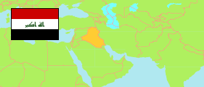
Karbalā'
Governorate in Iraq
Contents: Subdivision
The population development in Karbalā' as well as related information and services (Wikipedia, Google, images).
| Name | Status | Native | Population Estimate 2009-10-17 | Population Estimate 2018-07-01 | |
|---|---|---|---|---|---|
| Karbalā' [Kerbala] | Governorate | كربلاء | 1,013,254 | 1,218,732 | |
| Al-Hindiyah | District | الھندیة | 218,690 | 261,671 | → |
| At-Tamur | District | التمر | 23,802 | 28,477 | → |
| Karbalā' [Kerbala] | District | كربلاء | 770,762 | 928,584 | → |
| Al-'Irāq [Iraq] | Republic | 31,664,466 | 38,124,182 |
Source: Central Organization for Statistics and Information Technology (web).
Explanation: Area figures of districts are computed by using geospatial data.
