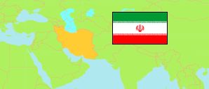
Iran: Kermanshah
Counties
The population of the counties in Kermanshah (Kermānshāh) Province by census years.
| Name | Native | Status | Population Census 1996-10-25 | Population Census 2006-10-25 | Population Census 2011-10-24 | Population Census 2016-09-24 | |
|---|---|---|---|---|---|---|---|
| Dālāhū | شهرستان دالاهو | County | ... | ... | 39,837 | 35,987 | → |
| Eslāmābād-e Gharb | شهرستان اسلام آبادغرب | County | ... | ... | 151,473 | 140,876 | → |
| Gīlān-e Gharb | شهرستان گیلانغرب | County | ... | ... | 62,858 | 57,007 | → |
| Harsīn | شهرستان هرسین | County | ... | ... | 86,342 | 78,350 | → |
| Javānrūd | شهرستان جوانرود | County | ... | ... | 71,235 | 75,169 | → |
| Kangāvar | شهرستان کنگاور | County | ... | ... | 81,051 | 76,216 | → |
| Kermānshāh | شهرستان کرمانشاه | County | ... | ... | 1,030,978 | 1,083,833 | → |
| Pāveh | شهرستان پاوه | County | ... | ... | 56,837 | 60,431 | → |
| Qaṣr-e Shīrīn | شهرستان قصر شیرین | County | ... | ... | 25,517 | 23,929 | → |
| Ravānsar | شهرستان روانسر | County | ... | ... | 46,395 | 47,657 | → |
| Ṣaḥneh | شهرستان صحنه | County | ... | ... | 76,678 | 70,757 | → |
| Sarpol-e Dhahāb [Sarpol-e Zahab] | شهرستان سرپل ذهاب | County | ... | ... | 85,616 | 85,342 | → |
| Sonqor | شهرستان سنقر | County | ... | ... | 91,935 | 81,661 | → |
| Ṭalāṭ Bābājānī [Salas-e Babajani] | شهرستان ثلاث باباجانی | County | ... | ... | 38,475 | 35,219 | → |
| Kermānshāh | کرمانشاه | Province | 1,778,596 | 1,879,385 | 1,945,227 | 1,952,434 |
Contents: Cities
The population of all cities in Kermanshah (Kermānshāh) Province by census years.
| Name | Native | Status | County | Population Census 1996-10-25 | Population Census 2006-10-25 | Population Census 2011-10-24 | Population Census 2016-09-24 | |
|---|---|---|---|---|---|---|---|---|
| Bānevreh | بانهوره | City | Pāveh | ... | ... | ... | 3,187 | → |
| Bāyangān | باینگان | City | Pāveh | 2,265 | 1,788 | 1,731 | 1,513 | → |
| Bīsotūn | بیستون | City | Harsīn | ... | 2,095 | 5,107 | 4,942 | → |
| Eslāmābād-e Gharb | اسلامآباد غرب | City | Eslāmābād-e Gharb | 81,614 | 89,904 | 94,699 | 90,559 | → |
| Ezgoleh | ازگله | City | Ṭalāṭ Bābājānī | ... | 1,007 | 1,256 | 1,502 | → |
| Gahvāreh | گهواره | City | Dālāhū | ... | 4,918 | 4,619 | 4,050 | → |
| Gīlān-e Gharb | گیلانغرب | City | Gīlān-e Gharb | 16,813 | 19,493 | 20,922 | 22,331 | → |
| Gowdīn | گودین | City | Kangāvar | ... | ... | ... | 2,629 | → |
| Halashī | هلشی | City | Kermānshāh | ... | 457 | 769 | 804 | → |
| Harsīn | هرسین | City | Harsīn | 55,079 | 51,636 | 49,967 | 44,146 | → |
| Ḥomeyl | حمیل | City | Eslāmābād-e Gharb | ... | 1,344 | 1,363 | 1,317 | → |
| Javānrūd | جوانرود | City | Javānrūd | 33,317 | 43,492 | 51,483 | 54,354 | → |
| Kangāvar | کنگاور | City | Kangāvar | 50,269 | 48,978 | 53,449 | 51,352 | → |
| Kerend | کرند غرب | City | Dālāhū | 9,113 | 7,972 | 8,311 | 7,798 | → |
| Kermānshāh | کرمانشاه | City | Kermānshāh | 692,986 | 794,863 | 851,405 | 946,651 | → |
| Kūzarān | کوزران | City | Kermānshāh | ... | 3,762 | 3,934 | 4,007 | → |
| Mīān Rāhān | میانراهان | City | Ṣaḥneh | ... | 531 | 598 | 695 | → |
| Nowdeshah | نودشه | City | Pāveh | 4,368 | 3,605 | 3,077 | 3,683 | → |
| Nowsūd | نوسود | City | Pāveh | 1,368 | 1,617 | 1,730 | 1,949 | → |
| Pāveh | پاوه | City | Pāveh | 17,565 | 20,068 | 23,704 | 25,771 | → |
| Qaṣr-e Shīrīn | قصر شیرین | City | Qaṣr-e Shīrīn | 12,726 | 15,817 | 17,959 | 18,473 | → |
| Ravānsar | روانسر | City | Ravānsar | 15,063 | 16,546 | 21,250 | 24,527 | → |
| Rījāb | ریجاب | City | Dālāhū | ... | ... | ... | 3,907 | → |
| Robāṭ | رباط | City | Kermānshāh | 1,012 | 1,008 | 940 | 823 | → |
| Ṣaḥneh | صحنه | City | Ṣaḥneh | 31,048 | 34,462 | 36,542 | 35,508 | → |
| Sarmast | سرمست | City | Gīlān-e Gharb | ... | 2,447 | 2,858 | 2,913 | → |
| Sarpol-e Dhahāb [Sarpol-e Zahab] | سرپل ذهاب | City | Sarpol-e Dhahāb | 27,418 | 34,669 | 35,809 | 45,481 | → |
| Saṭar | سطر | City | Sonqor | ... | 1,291 | 1,227 | 1,048 | → |
| Shāhū | شاهو | City | Ravānsar | ... | ... | 3,342 | 3,558 | → |
| Sonqor | سنقر | City | Sonqor | 40,848 | 43,653 | 44,954 | 44,256 | → |
| Sūmār | سومار | City | Qaṣr-e Shīrīn | 326 | 78 | 9 | 180 | → |
| Tāzeh Ābād | تازهآباد | City | Ṭalāṭ Bābājānī | 5,084 | 7,818 | 12,080 | 14,701 | → |
Source: Statistical Centre of Iran (web).