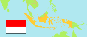
Donggala
Regency in Central Sulawesi Province
Contents: Subdivision
The population in Donggala as well as related information and services (Wikipedia, Google, images).
| Name | Status | Population Census 2010-05-01 | |
|---|---|---|---|
| Donggala | Regency | 277,620 | |
| Balaesang | District | 22,796 | → |
| Balaesang Tanjung | District | 10,350 | → |
| Banawa | District | 32,018 | → |
| Banawa Selatan | District | 23,677 | → |
| Banawa Tengah | District | 10,072 | → |
| Damsol (Dampelas) | District | 28,938 | → |
| Labuan | District | 13,319 | → |
| Pinembani | District | 5,936 | → |
| Rio Pakava | District | 21,820 | → |
| Sindue | District | 18,436 | → |
| Sindue Tobata | District | 8,775 | → |
| Sindue Tombusabora | District | 11,320 | → |
| Sirenja | District | 20,206 | → |
| Sojol | District | 25,419 | → |
| Sojol Utara | District | 9,356 | → |
| Tanantovea | District | 15,182 | → |
| Sulawesi Tengah [Central Sulawesi] | Province | 2,635,009 |
Source: Badan Pusat Statistik, Republik Indonesia (web).
Explanation: Districts in the boundaries of 2010; their area is computed by using geospatial data. Regencies and cities as defined in 2015.