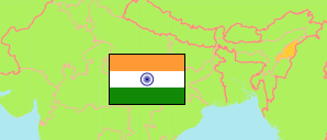
State
The population development of the State of Nāgāland by census years.
| Name | Abbr. | Status | Capital | Area A (km²) | Population Census (Cf) 1981-03-01 | Population Census (Cf) 1991-03-01 | Population Census (Cf) 2001-03-01 | Population Census (Cf) 2011-03-01 | Population Projection (P) 2023-03-01 | |||
|---|---|---|---|---|---|---|---|---|---|---|---|---|
| India | IND | Rep | New Delhi | 3,166,620 | 685,184,692 | 846,387,888 | 1,028,737,436 | 1,210,854,977 | 1,387,284,900 | → | ||
| Nāgāland | NAG | St | Kohīma | 16,579 | 774,930 | 1,209,546 | 1,990,036 | 1,978,502 | 2,233,000 | 1657900 | → |
- Office of the Registrar General and Census Commissioner.
(2023) National Commission on Population (adapted by Unique Identification Authority of India).
Contents: Cities & Towns
The population development of all cities and towns in Nāgāland with more than 20,000 inhabitants by census years.
| Name | Status | Population Census (Cf) 1991-03-01 | Population Census (Cf) 2001-03-01 | Population Census (Cf) 2011-03-01 | Area | ||
|---|---|---|---|---|---|---|---|
| Chumukedima | Town | 8,796 | 16,504 | 25,885 | 1020 | → | |
| Dimāpur | City | 57,182 | 98,096 | 122,834 | 2554 | → | |
| Kohīma | City | 51,418 | 77,030 | 99,039 | 2300 | → | |
| Mokokchūng | City | 24,803 | 31,214 | 35,913 | 3200 | → | |
| Mon | Town | ... | 16,590 | 26,328 | 900 | → | |
| Tuensang | Town | 21,018 | 29,772 | 36,774 | 3198 | → | |
| Wokha | Town | 14,377 | 37,636 | 35,004 | 592 | → | |
| Zunheboto | Town | 11,473 | 23,081 | 22,633 | 600 | → |
- (2001) (2011) Office of the Registrar General and Census Commissioner, Delimitation Commission of India, Population Census India.
