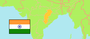
The State of Chhattīsgarh was formed in 2000 from southeastern districts of Madhya Pradesh.
State
The population development of the State of Chhattīsgarh by census years.
| Name | Abbr. | Status | Capital | Area A (km²) | Population Census (Cf) 1991-03-01 | Population Census (Cf) 2001-03-01 | Population Census (Cf) 2011-03-01 | Population Projection (P) 2023-03-01 | |||
|---|---|---|---|---|---|---|---|---|---|---|---|
| India | IND | Rep | New Delhi | 3,166,620 | 846,387,888 | 1,028,737,436 | 1,210,854,977 | 1,387,284,900 | → | ||
| Chhattīsgarh | CHH | St | Raipur | 135,192 | 17,614,928 | 20,833,803 | 25,545,198 | 30,180,000 | 13519200 | → |
- Office of the Registrar General and Census Commissioner.
(2023) National Commission on Population (adapted by Unique Identification Authority of India).
Major Agglomerations
| Name | Population Census (Cf) 2011-03-01 | |
|---|---|---|
| 1 | Raipur | 1,123,558 |
| 2 | Bhilai | 1,064,222 |
| 3 | Bilāspur | 453,946 |
| 4 | Korba | 365,253 |
| 5 | Rāj Nāndgaon | 163,114 |
| 6 | Raigarh | 150,019 |
| 7 | Jagdalpur | 125,463 |
| 8 | Ambikāpur | 121,071 |
| 9 | Dhamtari | 101,677 |
Contents: Agglomerations & Cities
The population development of all urban agglomerations and single cities in Chhattīsgarh with more than 20,000 inhabitants by census years.
| Name | Status | Population Census (Cf) 1991-03-01 | Population Census (Cf) 2001-03-01 | Population Census (Cf) 2011-03-01 | Area | ||
|---|---|---|---|---|---|---|---|
| Ahiwara | Town | 18,702 | 18,719 | 20,384 | 2778 | → | |
| Akaltara | City | 17,854 | 20,367 | 22,712 | 1971 | → | |
| Ambikāpur | CityOG | 53,227 | 90,967 | 121,071 | 2130 | → | |
| Bade Bacheli | City | 12,582 | 20,411 | 21,435 | 3534 | → | |
| Baikunthpur | City | ... | 10,077 | 28,431 | 229 | → | |
| Balod | City | 17,916 | 21,165 | 23,648 | 462 | → | |
| Baloda Bāzār | City | 17,373 | 22,853 | 26,632 | 756 | → | |
| Bemetāra | City | 19,093 | 23,315 | 28,536 | 1182 | → | |
| Bhātāpāra | City | 45,468 | 50,118 | 57,537 | 761 | → | |
| Bhilai (Bhilai Nagar) | Aggl | 685,474 | 927,864 | 1,064,222 | 34075 | → | |
| Bilāspur | Aggl | 229,615 | 335,293 | 453,946 | 5011 | → | |
| Chāmpa | City | 30,086 | 37,951 | 45,256 | 1893 | → | |
| Chirmiri | City | 28,849 | 93,373 | 85,317 | 6494 | → | |
| Dalli-Rajhara | Aggl | ... | 57,058 | 50,523 | 3725 | → | |
| Dhamtari | CityOG | 69,357 | 82,111 | 101,677 | 2340 | → | |
| Dipka | City | ... | 20,150 | 27,158 | 745 | → | |
| Dongragarh | City | 31,459 | 34,441 | 37,372 | 643 | → | |
| Gobranawāpāra | City | 21,003 | 25,591 | 29,315 | 783 | → | |
| Jagdalpur | City | 84,578 | 103,123 | 125,463 | 2638 | → | |
| Jashpurnagar | CityOG | 14,788 | 20,239 | 28,301 | 1266 | → | |
| Kānker | CityOG | 20,702 | 31,385 | 37,442 | 2393 | → | |
| Katghora | Town | 14,761 | 18,523 | 22,690 | 1798 | → | |
| Kawardha | CityOG | 23,916 | 32,415 | 46,657 | 1160 | → | |
| Khairāgarh | City | 13,569 | 15,157 | 22,564 | 280 | → | |
| Kondagaon | City | 24,398 | 26,898 | 30,921 | 739 | → | |
| Korba | CityOG | 124,501 | 315,690 | 365,253 | 21502 | → | |
| Mahāsamund | CityOG | 39,176 | 47,100 | 54,413 | 1468 | → | |
| Manendragarh | City | 26,326 | 30,758 | 33,071 | 693 | → | |
| Mungeli | CityOG | 26,340 | 31,613 | 36,450 | 1259 | → | |
| Naila Jānjgīr | City | 24,754 | 32,513 | 40,561 | 1936 | → | |
| Narayanpur | Town | ... | 16,386 | 22,106 | 0 | → | |
| Raigarh | CityOG | 90,265 | 115,908 | 150,019 | 2068 | → | |
| Raipur | Aggl | 462,694 | 700,113 | 1,123,558 | 11603 | → | |
| Rāj Nāndgaon | City | 129,371 | 143,770 | 163,114 | 7809 | → | |
| Ratanpur | Town | 16,069 | 19,839 | 24,636 | 4426 | → | |
| Sakti | City | 16,894 | 20,213 | 21,955 | 907 | → | |
| Saraipāli | Town | 13,869 | 17,081 | 20,043 | 1265 | → | |
| Shivpur Charcha | City | 13,404 | 15,217 | 23,514 | 384 | → | |
| Surajpur | City | 13,049 | 16,834 | 20,189 | 1367 | → | |
| Takhatpur | Town | 14,733 | 17,005 | 19,968 | 500 | → | |
| Tilda Neora | CityOG | 20,578 | 26,909 | 36,682 | 3455 | → |
- (2001) (2011) Office of the Registrar General and Census Commissioner, Delimitation Commission of India, Population Census India.