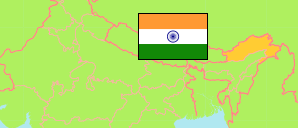
China claims the northern parts of Arunāchal Pradesh.
State
The population development of the State of Arunāchal Pradesh by census years.
| Name | Abbr. | Status | Capital | Area A (km²) | Population Census (Cf) 1981-03-01 | Population Census (Cf) 1991-03-01 | Population Census (Cf) 2001-03-01 | Population Census (Cf) 2011-03-01 | Population Projection (P) 2023-03-01 | |||
|---|---|---|---|---|---|---|---|---|---|---|---|---|
| India | IND | Rep | New Delhi | 3,166,620 | 685,184,692 | 846,387,888 | 1,028,737,436 | 1,210,854,977 | 1,387,284,900 | → | ||
| Arunāchal Pradesh | ARU | St | Itānagar | 83,743 | 631,839 | 864,558 | 1,097,968 | 1,383,727 | 1,562,000 | 8374300 | → |
- Office of the Registrar General and Census Commissioner.
(2023) National Commission on Population (adapted by Unique Identification Authority of India).
Contents: Towns
The population development of all towns in Arunāchal Pradesh with more than 20,000 inhabitants by census years.
| Name | Status | Population Census (Cf) 1991-03-01 | Population Census (Cf) 2001-03-01 | Population Census (Cf) 2011-03-01 | Area | ||
|---|---|---|---|---|---|---|---|
| Aalo (Along) | Town | 13,239 | 17,033 | 20,684 | 1050 | → | |
| Itānagar | Town | 16,545 | 35,022 | 59,490 | 0 | → | |
| Naharlagun | Town | 14,369 | 27,020 | 36,158 | 0 | → | |
| Pāsighāt | Town | 14,639 | 21,965 | 24,656 | 1011 | → |
- (2001) (2011) Office of the Registrar General and Census Commissioner, Delimitation Commission of India, Population Census India.
