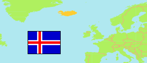
Suðurnes
Region in Iceland
Contents: Subdivision
The population development in Suðurnes as well as related information and services (Wikipedia, Google, images).
| Name | Status | Population Estimate 2000-01-01 | Population Estimate 2005-01-01 | Population Estimate 2010-01-01 | Population Estimate 2015-01-01 | Population Estimate 2020-01-01 | Population Estimate 2024-01-01 | |
|---|---|---|---|---|---|---|---|---|
| Suðurnes [Southern Peninsula] | Region | 16,106 | 17,110 | 21,359 | 21,662 | 26,835 | 30,933 | |
| Grindavíkurbær [→ due to volcanic eruptions, no one dwelled in Grindavík on 1 January 2024] | Municipality | 2,242 | 2,494 | 2,837 | 2,955 | 3,419 | 3,579 | → |
| Reykjanesbær | Municipality | 10,624 | 10,952 | 14,091 | 14,658 | 18,622 | 21,957 | → |
| Suðurnesjabær (incl. Garður, Sandgerði) | Municipality | 2,508 | 2,727 | 3,225 | 2,960 | 3,526 | 3,897 | → |
| Vogar (Sveitarfélagið Vogar) | Municipality | 732 | 937 | 1,206 | 1,089 | 1,268 | 1,500 | → |
| Ísland [Iceland] | Country | 279,049 | 293,577 | 317,630 | 323,024 | 354,042 | 383,726 |
Source: Statistics Iceland.
Further information about the population structure:
| Gender (E 2024) | |
|---|---|
| Males | 16,579 |
| Females | 14,347 |
| Non-binary/Other | 7 |
| Age Groups (E 2024) | |
|---|---|
| 0-17 years | 7,005 |
| 18-64 years | 20,272 |
| 65+ years | 3,656 |
| Age Distribution (E 2024) | |
|---|---|
| 90+ years | 108 |
| 80-89 years | 596 |
| 70-79 years | 1,604 |
| 60-69 years | 2,910 |
| 50-59 years | 3,355 |
| 40-49 years | 4,373 |
| 30-39 years | 5,360 |
| 20-29 years | 4,863 |
| 10-19 years | 3,999 |
| 0-9 years | 3,765 |
| Citizenship (E 2023) | |
|---|---|
| Iceland | 22,730 |
| Foreign Citizenship | 8,320 |
