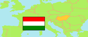
Veszprém
County in Hungary
Contents: Subdivision
The population development in Veszprém as well as related information and services (Wikipedia, Google, images).
| Name | Status | Population Census 1980-01-01 | Population Census 1990-01-01 | Population Census 2001-02-01 | Population Census 2011-10-01 | Population Census 2022-10-01 | |
|---|---|---|---|---|---|---|---|
| Veszprém | County | 377,746 | 374,466 | 369,727 | 353,068 | 335,361 | |
| Ajka | District | 44,258 | 44,142 | 42,315 | 39,160 | 36,538 | → |
| Balatonalmádi | District | 24,049 | 24,201 | 23,651 | 24,330 | 25,941 | → |
| Balatonfüred | District | 22,889 | 23,890 | 23,193 | 23,849 | 24,417 | → |
| Devecser | District | 20,210 | 17,767 | 17,192 | 15,079 | 14,133 | → |
| Pápa | District | 69,573 | 65,783 | 63,866 | 59,310 | 55,102 | → |
| Sümeg | District | 18,043 | 16,834 | 16,336 | 15,358 | 14,453 | → |
| Tapolca | District | 39,572 | 38,630 | 37,356 | 34,256 | 32,176 | → |
| Várpalota | District | 41,000 | 38,993 | 39,527 | 37,882 | 35,917 | → |
| Veszprém | District | 75,060 | 81,809 | 84,390 | 83,288 | 78,390 | → |
| Zirc | District | 21,691 | 21,026 | 20,747 | 19,386 | 18,294 | → |
| Magyarország [Hungary] | Country | 10,709,463 | 10,374,823 | 10,198,315 | 9,937,628 | 9,603,634 |
Source: Hungarian Central Statistical Office.
Explanation: 2022 census results are final.
Further information about the population structure:
| Gender (C 2022) | |
|---|---|
| Males | 162,797 |
| Females | 172,564 |
| Age Groups (C 2022) | |
|---|---|
| 0-17 years | 56,208 |
| 18-64 years | 205,015 |
| 65+ years | 74,138 |
| Age Distribution (C 2022) | |
|---|---|
| 90+ years | 1,976 |
| 80-89 years | 14,222 |
| 70-79 years | 32,750 |
| 60-69 years | 47,279 |
| 50-59 years | 46,814 |
| 40-49 years | 54,855 |
| 30-39 years | 40,768 |
| 20-29 years | 33,949 |
| 10-19 years | 32,232 |
| 0-9 years | 30,516 |
