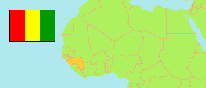
Nzérékoré
Prefecture in Guinea
Contents: Subdivision
The population development in Nzérékoré as well as related information and services (Wikipedia, Google, images).
| Name | Status | Population Census 1996-12-31 | Population Census 2014-03-01 | |
|---|---|---|---|---|
| Nzérékoré | Prefecture | 283,413 | 396,949 | |
| Bounouma | Sub-Prefecture | 22,364 | 21,988 | → |
| Gouécké | Sub-Prefecture | 14,481 | 19,177 | → |
| Kobéla | Sub-Prefecture | 11,786 | 15,198 | → |
| Koropara | Sub-Prefecture | 16,090 | 19,035 | → |
| Koulé | Sub-Prefecture | 14,421 | 18,922 | → |
| Nzérékoré-Centre | Urban Commune | 110,209 | 195,330 | → |
| Palé | Sub-Prefecture | 9,516 | 10,125 | → |
| Samoé | Sub-Prefecture | 33,128 | 37,543 | → |
| Soulouta (Soulouma) | Sub-Prefecture | 14,911 | 21,789 | → |
| Womey | Sub-Prefecture | 12,948 | 12,828 | → |
| Yalenzou | Sub-Prefecture | 24,776 | 25,014 | → |
| Guinea | Republic | 7,156,406 | 10,523,261 |
Source: Institut National de la Statistique de Guinée (web).
Explanation: The 1996 population of sub-prefectures and urban communes shows slight discrepancies compared to the population of prefectures.
Further information about the population structure:
| Gender (C 2014) | |
|---|---|
| Males | 194,055 |
| Females | 202,894 |
| Age Groups (P 2014) | |
|---|---|
| 0-14 years | 192,835 |
| 15-64 years | 241,766 |
| 65+ years | 13,899 |
| Age Distribution (P 2014) | |
|---|---|
| 0-9 years | 135,975 |
| 10-19 years | 111,024 |
| 20-29 years | 74,964 |
| 30-39 years | 51,743 |
| 40-49 years | 33,406 |
| 50-59 years | 20,652 |
| 60-69 years | 11,770 |
| 70-79 years | 5,908 |
| 80+ years | 3,058 |
| Urbanization (C 2014) | |
|---|---|
| Rural | 201,922 |
| Urban | 195,027 |