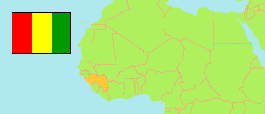
Siguiri
Prefecture in Guinea
Contents: Subdivision
The population development in Siguiri as well as related information and services (Wikipedia, Google, images).
| Name | Status | Population Census 1996-12-31 | Population Census 2014-03-01 | |
|---|---|---|---|---|
| Siguiri | Prefecture | 271,224 | 687,002 | |
| Bankon | Sub-Prefecture | 10,640 | 18,263 | → |
| Doko | Sub-Prefecture | 32,711 | 86,782 | → |
| Franwalia | Sub-Prefecture | 16,165 | 29,272 | → |
| Kiniébakoura | Sub-Prefecture | 14,559 | 28,684 | → |
| Kintinian | Sub-Prefecture | 26,272 | 124,847 | → |
| Maléa | Sub-Prefecture | 17,770 | 27,471 | → |
| Naboun | Sub-Prefecture | 13,204 | 25,348 | → |
| Niagassola | Sub-Prefecture | 15,270 | 30,640 | → |
| Niandankoro | Sub-Prefecture | 12,221 | 23,855 | → |
| Norassoba | Sub-Prefecture | 32,987 | 40,137 | → |
| Nounkounkan (← Norassoba) | Sub-Prefecture | ... | 12,875 | → |
| Siguiri-Centre | Urban Commune | 54,671 | 183,875 | → |
| Siguirini | Sub-Prefecture | 23,750 | 54,953 | → |
| Guinea | Republic | 7,156,406 | 10,523,261 |
Source: Institut National de la Statistique de Guinée (web).
Explanation: The 1996 population of sub-prefectures and urban communes shows slight discrepancies compared to the population of prefectures.
Further information about the population structure:
| Gender (C 2014) | |
|---|---|
| Males | 346,276 |
| Females | 340,726 |
| Age Groups (P 2014) | |
|---|---|
| 0-14 years | 377,216 |
| 15-64 years | 372,966 |
| 65+ years | 16,412 |
| Age Distribution (P 2014) | |
|---|---|
| 0-9 years | 283,841 |
| 10-19 years | 178,052 |
| 20-29 years | 128,798 |
| 30-39 years | 83,073 |
| 40-49 years | 44,369 |
| 50-59 years | 24,350 |
| 60-69 years | 14,168 |
| 70-79 years | 6,995 |
| 80+ years | 2,948 |
| Urbanization (C 2014) | |
|---|---|
| Rural | 559,510 |
| Urban | 127,492 |