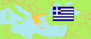
Ágrafa
in Dímos Agráfon (Central Greece)
Contents: Settlement
The population development of Ágrafa as well as related information and services (weather, Wikipedia, Google, images).
| Name | Native | Municipality | Population Census 1991-03-17 | Population Census 2001-03-18 | Population Census 2011-03-16 | Population Census 2021-10-22 | |
|---|---|---|---|---|---|---|---|
| Ágrafa | Άγραφα | Dímos Agráfon | 195 | 256 | 310 | 293 | → |
Source: General Secretariat of National Statistical Service of Greece.
Further information about the population structure:
| Gender (C 2021) | |
|---|---|
| Males | 164 |
| Females | 132 |
| Age Groups (C 2021) | |
|---|---|
| 0-14 years | 20 |
| 15-59 years | 174 |
| 65+ years | 100 |
| Age Distribution (C 2021) | |
|---|---|
| 70+ years | 69 |
| 60-69 years | 53 |
| 50-59 years | 57 |
| 40-49 years | 23 |
| 30-39 years | 28 |
| 20-29 years | 36 |
| 10-19 years | 11 |
| 0-9 years | 17 |
| Urbanization (C 2021) | |
|---|---|
| Rural | 293 |
| Place of Birth (C 2021) | |
|---|---|
| Same municipality | 206 |
| Other municipality in same region | 4 |
| Other region | 73 |
| Other country | 8 |
