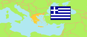
Pelopónnisos
NUTS 2 Region in Greece
Contents: Subdivision
The population development in Pelopónnisos as well as related information and services (Wikipedia, Google, images).
| Name | Status | Native | Population Estimate 2002-01-01 | Population Estimate 2007-01-01 | Population Estimate 2012-01-01 | Population Estimate 2017-01-01 | Population Estimate 2023-01-01 | |
|---|---|---|---|---|---|---|---|---|
| Pelopónnisos [Peloponnese] | NUTS 2 Region | Πελοπόννησος | 594,637 | 585,499 | 589,044 | 579,182 | 534,345 | |
| Nomós Argolídos kai Arkadías [Argolis - Arcadia] | NUTS 3 Region | Νομός Αργολιδος και Αρκαδιας | 192,276 | 188,640 | 186,786 | 180,508 | 168,859 | → |
| Nomós Korinthías [Corinthia] | NUTS 3 Region | Νομός Κορινθίας | 146,790 | 145,283 | 148,549 | 148,540 | 136,827 | → |
| Nomós Lakonías kai Messinías [Laconia - Messenia] | NUTS 3 Region | Νομός Λακωνίας και Μεσσηνίας | 255,571 | 251,576 | 253,709 | 250,134 | 228,659 | → |
| Elláda [Greece] | Republic | Ελλάδα | 10,888,274 | 11,036,008 | 11,086,406 | 10,768,193 | 10,413,982 |
Source: General Secretariat of National Statistical Service of Greece.
Explanation: NUTS (Nomenclature of Territorial Units for Statistics) regions are statistical regions of the EU.
