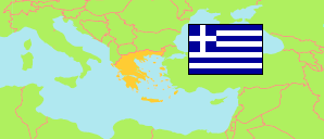
Anatolikí Makedonía kai Thrakí
NUTS 2 Region in Greece
Contents: Subdivision
The population development in Anatolikí Makedonía kai Thrakí as well as related information and services (Wikipedia, Google, images).
| Name | Status | Native | Population Estimate 2002-01-01 | Population Estimate 2007-01-01 | Population Estimate 2012-01-01 | Population Estimate 2017-01-01 | Population Estimate 2023-01-01 | |
|---|---|---|---|---|---|---|---|---|
| Anatolikí Makedonía kai Thrakí [Eastern Macedonia and Thrace] | NUTS 2 Region | Ανατολική Μακεδονία και Θράκη | 589,489 | 602,965 | 612,074 | 602,799 | 559,730 | |
| Nomós Drámas [Drama] | NUTS 3 Region | Νομός Δράμας | 96,234 | 97,460 | 98,571 | 96,836 | 86,084 | → |
| Nomós Évrou [Evros] | NUTS 3 Region | Νομός Έβρου | 144,134 | 146,507 | 147,996 | 147,709 | 133,467 | → |
| Nomós Kaválas kai Thásou [Kavala - Thasos] | NUTS 3 Region | Νομός Καβάλας και Θάσου | 138,770 | 139,582 | 139,393 | 134,411 | 127,545 | → |
| Nomós Rodópis [Rhodope] | NUTS 3 Region | Νομός Ροδόπης | 106,252 | 110,192 | 113,244 | 111,731 | 104,948 | → |
| Nomós Xánthis [Xanthi] | NUTS 3 Region | Νομός Ξάνθης | 104,099 | 109,224 | 112,870 | 112,112 | 107,686 | → |
| Elláda [Greece] | Republic | Ελλάδα | 10,888,274 | 11,036,008 | 11,086,406 | 10,768,193 | 10,413,982 |
Source: General Secretariat of National Statistical Service of Greece.
Explanation: NUTS (Nomenclature of Territorial Units for Statistics) regions are statistical regions of the EU.
