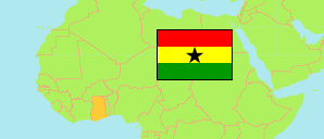
Western
Region in Ghana
Contents: Subdivision
The population development in Western as well as related information and services (Wikipedia, Google, images).
| Name | Status | Population Census 2010-09-26 | Population Census 2021-06-27 | |
|---|---|---|---|---|
| Western | Region | 1,664,586 | 2,060,585 | |
| Ahanta West Municipal | Municipal District | 106,215 | 153,140 | → |
| Effia-Kwesimintsim Municipal (← Sekondi Takoradi Metropolitan) | Municipal District | 232,617 | 173,975 | → |
| Ellembelle | District | 87,501 | 120,893 | → |
| Jomoro Municipal | Municipal District | 150,107 | 126,576 | → |
| Mpohor | District | 42,923 | 52,473 | → |
| Nzema East Municipal | Municipal District | 60,828 | 94,621 | → |
| Prestea-Huni Valley Municipal | Municipal District | 159,304 | 229,301 | → |
| Sekondi Takoradi Metropolitan (incl. Sekondi Municipal, Takoradi Municipal, Essikado Municipal) | Metropolitan District | 326,931 | 245,382 | → |
| Shama | District | 81,966 | 117,224 | → |
| Tarkwa Nsuaem Municipal | Municipal District | 90,477 | 218,664 | → |
| Wassa Amenfi Central | District | 69,014 | 119,117 | → |
| Wassa Amenfi East Municipal | Municipal District | 83,478 | 179,696 | → |
| Wassa Amenfi West Municipal | Municipal District | 92,152 | 129,882 | → |
| Wassa East | District | 81,073 | 99,641 | → |
| Ghana | Republic | 24,658,823 | 30,832,019 |
Source: Ghana Statistical Service (web).
Explanation: Area figures of districts are derived from geospatial data.
Further information about the population structure:
| Gender (C 2021) | |
|---|---|
| Males | 1,045,227 |
| Females | 1,015,358 |
| Age Groups (C 2021) | |
|---|---|
| 0-14 years | 709,467 |
| 15-64 years | 1,280,961 |
| 65+ years | 70,157 |
| Age Distribution (C 2021) | |
|---|---|
| 80+ years | 14,460 |
| 70-79 years | 29,473 |
| 60-69 years | 67,872 |
| 50-59 years | 117,446 |
| 40-49 years | 194,423 |
| 30-39 years | 316,688 |
| 20-29 years | 390,565 |
| 10-19 years | 444,015 |
| 0-9 years | 485,643 |
| Urbanization (C 2021) | |
|---|---|
| Rural | 997,720 |
| Urban | 1,062,865 |
| Literacy (A11+) (C 2021) | |
|---|---|
| yes | 1,150,985 |
| no | 371,418 |
| Ethnic Group (C 2021) | |
|---|---|
| Akan | 1,594,154 |
| Ga-Dangme | 51,402 |
| Ewe | 129,869 |
| Guan | 7,790 |
| Gurma | 32,094 |
| Mole-Dagbani | 169,520 |
| Grusi | 23,066 |
| Mandé | 15,155 |
| Other Ethnic Group | 20,571 |