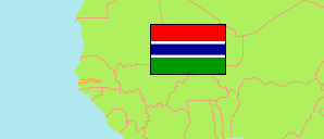
Janjanbureh
Local Government Area in Gambia
Contents: Subdivision
The population development in Janjanbureh as well as related information and services (Wikipedia, Google, images).
| Name | Status | Population Census 1993-04-15 | Population Census 2003-04-15 | Population Census 2013-04-15 | |
|---|---|---|---|---|---|
| Janjanbureh | Local Government Area | 88,247 | 107,212 | 125,204 | |
| Janjanbureh (McCarthy Island) | District | 2,813 | 3,466 | 3,789 | → |
| Lower Fuladu West (← Fuladu West) | District | ... | ... | 39,804 | → |
| Niamina Dankunku | District | 6,089 | 6,000 | 6,083 | → |
| Niamina East | District | 15,402 | 19,034 | 24,340 | → |
| Niamina West | District | 5,948 | 6,630 | 7,141 | → |
| Upper Fuladu West (← Fuladu West) | District | ... | ... | 44,047 | → |
| Gambia | Republic | 1,038,145 | 1,360,681 | 1,857,181 |
Source: The Gambia Bureau of Statistics (web).
Explanation: Area figures of districts are computed by using geospatial data.
Further information about the population structure:
| Gender (C 2013) | |
|---|---|
| Males | 60,000 |
| Females | 65,204 |
| Age Groups (C 2013) | |
|---|---|
| 0-14 years | 58,536 |
| 15-49 years | 54,984 |
| 50+ years | 11,668 |