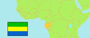
Haut-Ogooué
Province in Gabon
Contents: Subdivision
The population development in Haut-Ogooué as well as related information and services (Wikipedia, Google, images).
| Name | Status | Population Census 2003-12-01 | Population Census 2013-10-01 | |
|---|---|---|---|---|
| Haut-Ogooué | Province | 228,471 | 250,799 | |
| Bayi-Brikolo | Department | 4,778 | 1,998 | → |
| Djoué | Department | 3,503 | 2,178 | → |
| Djouori-Agnili | Department | 4,301 | 4,210 | → |
| Lébombi-Léyou (Lemboumbi-Leyou) | Department | 53,921 | 64,569 | → |
| Lékabi-Léwolo | Department | 6,417 | 4,914 | → |
| Lékoko | Department | 3,412 | 4,920 | → |
| Lékoni-Lékori | Department | 8,978 | 10,028 | → |
| Mpassa | Department | 117,768 | 129,694 | → |
| Ogooué-Létili | Department | 4,043 | 2,791 | → |
| Plateaux | Department | 9,122 | 9,054 | → |
| Sébé-Brikolo | Department | 12,228 | 16,443 | → |
| Gabon | Republic | 1,517,685 | 1,811,079 |
Source: Direction Generale de la Statistique et des Etudes Economiques, Gabon (via GeoHive / Statoids), Direction Generale de la Statistique du Gabon: Résultats globaux du Recensement Général de la Population et des Logements de 2013 du Gabon.
Explanation: Area figures of departments are mostly derived from geospatial data.
