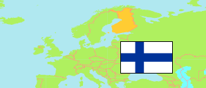
Ulvila
Municipality in Satakunta
Municipality
The population development of Ulvila.
| Name | Status | Population Estimate 2011-12-31 | Population Estimate 2016-12-31 | Population Estimate 2021-12-31 | Population Estimate 2024-12-31 | |
|---|---|---|---|---|---|---|
| Ulvila | Municipality | 13,554 | 13,312 | 12,669 | 12,382 | → |
| Satakunta | Region | 225,302 | 221,481 | 214,281 | 211,261 |
Contents: Settlements
The population development of the settlements in Ulvila.
| Name | Status | Municipality | Population Estimate 2011-12-31 | Population Estimate 2016-12-31 | Population Estimate 2021-12-31 | Population Estimate 2024-12-31 | |
|---|---|---|---|---|---|---|---|
| Kaasmarkku | Settlement | Ulvila | 249 | 244 | 215 | 214 | → |
| Koski | Settlement | Ulvila | 402 | 353 | 352 | 330 | → |
| Pori | Central Locality | Pori / Ulvila / Harjavalta / Nakkila | 84,294 | 84,536 | 83,206 | 83,325 | → |
Source: Statistics Finland.
Explanation: Settlements according to the 2024 definition.