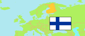
Mäntsälä
Municipality in Finland
Contents: Population
The population development of Mäntsälä as well as related information and services (Wikipedia, Google, images).
| Name | Status | Population Estimate 1980-12-31 | Population Estimate 1990-12-31 | Population Estimate 2000-12-31 | Population Estimate 2010-12-31 | Population Estimate 2020-12-31 | Population Estimate 2024-12-31 | |
|---|---|---|---|---|---|---|---|---|
| Mäntsälä | Municipality | 11,458 | 14,774 | 16,628 | 19,975 | 20,783 | 20,934 | |
| Suomi [Finland] | Republic | 4,787,778 | 4,998,478 | 5,181,115 | 5,375,276 | 5,533,793 | 5,635,971 |
Source: Statistics Finland.
Explanation: Regions and municipalities in the boundaries of 1 January 2025.
Further information about the population structure:
| Gender (E 2024) | |
|---|---|
| Males | 10,465 |
| Females | 10,469 |
| Age Groups (E 2024) | |
|---|---|
| 0-17 years | 4,565 |
| 18-64 years | 11,907 |
| 65+ years | 4,462 |
| Age Distribution (E 2024) | |
|---|---|
| 90+ years | 183 |
| 80-89 years | 848 |
| 70-79 years | 2,180 |
| 60-69 years | 2,688 |
| 50-59 years | 2,936 |
| 40-49 years | 2,939 |
| 30-39 years | 2,431 |
| 20-29 years | 1,629 |
| 10-19 years | 2,959 |
| 0-9 years | 2,141 |
| Citizenship (E 2024) | |
|---|---|
| Finland | 20,025 |
| Europe | 668 |
| Foreign Citizenship | 241 |
| Country of Birth (E 2024) | |
|---|---|
| Finland | 19,714 |
| Europe | 847 |
| Other country | 373 |
| Language (E 2024) | |
|---|---|
| Finnish | 19,540 |
| Swedish | 153 |
| Sami | 4 |
| Other language | 1,237 |
| Urbanization (E 2023) | |
|---|---|
| Outer urban | 1,182 |
| Peri-urban | 2,526 |
| Rural centers | 11,851 |
| Rural near urban areas | 5,149 |
