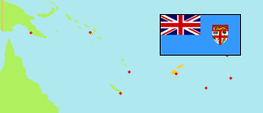
Rotuma
Dependency in Fiji
Contents: Subdivision
The population development in Rotuma as well as related information and services (Wikipedia, Google, images).
| Name | Status | Population Census 2007-09-16 | Population Census 2017-09-17 | |
|---|---|---|---|---|
| Rotuma | Dependency | 2,002 | 1,583 | |
| Itu'muta | District | 116 | 95 | → |
| Itu'ti'u | District | 740 | 660 | → |
| Juju | District | 257 | 209 | → |
| Malhaha | District | 241 | 233 | → |
| Noa'tau | District | 281 | 125 | → |
| Oinafa | District | 222 | 142 | → |
| Pepjei | District | 145 | 119 | → |
| Fiji | Republic | 837,271 | 884,887 |
Source: Fiji Islands Bureau of Statistics (web).
Explanation: The area figures of tikinas are computed by using geospatial data.
Further information about the population structure:
| Gender (C 2017) | |
|---|---|
| Males | 813 |
| Females | 770 |
| Age Groups (C 2017) | |
|---|---|
| 0-14 years | 491 |
| 15-64 years | 923 |
| 65+ years | 169 |
| Age Distribution (C 2017) | |
|---|---|
| 70+ years | 122 |
| 60-69 years | 126 |
| 50-59 years | 192 |
| 40-49 years | 198 |
| 30-39 years | 183 |
| 20-29 years | 142 |
| 10-19 years | 320 |
| 0-9 years | 300 |