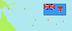
Lau
Province in Fiji
Contents: Subdivision
The population development in Lau as well as related information and services (Wikipedia, Google, images).
| Name | Status | Population Census 2007-09-16 | Population Census 2017-09-17 | |
|---|---|---|---|---|
| Lau | Province | 10,683 | 9,539 | |
| Cicia | Tikina | 1,024 | 1,028 | → |
| Kabara | Tikina | 873 | 656 | → |
| Lakeba | Tikina | 1,751 | 1,557 | → |
| Lomaloma | Tikina | 945 | 915 | → |
| Matuku | Tikina | 672 | 522 | → |
| Moala | Tikina | 1,384 | 1,383 | → |
| Moce | Tikina | 469 | 428 | → |
| Mualevu | Tikina | 1,033 | 838 | → |
| Nayau | Tikina | 338 | 293 | → |
| Oneata | Tikina | 154 | 147 | → |
| Ono | Tikina | 719 | 524 | → |
| Other Lau Islands | 230 | 292 | → | |
| Totoya | Tikina | 705 | 624 | → |
| Vulaga (Fulaga) | Tikina | 386 | 332 | → |
| Fiji | Republic | 837,271 | 884,887 |
Source: Fiji Islands Bureau of Statistics (web).
Explanation: The area figures of tikinas are computed by using geospatial data.
Further information about the population structure:
| Gender (C 2017) | |
|---|---|
| Males | 5,117 |
| Females | 4,422 |
| Age Groups (C 2017) | |
|---|---|
| 0-14 years | 3,439 |
| 15-64 years | 5,359 |
| 65+ years | 741 |
| Age Distribution (C 2017) | |
|---|---|
| 70+ years | 467 |
| 60-69 years | 613 |
| 50-59 years | 1,059 |
| 40-49 years | 995 |
| 30-39 years | 1,242 |
| 20-29 years | 1,119 |
| 10-19 years | 1,676 |
| 0-9 years | 2,368 |