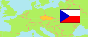
Most
District in Ústecký kraj
District
The population development of Most.
| Name | Status | Population Census 2001-03-01 | Population Census 2011-03-26 | Population Census 2021-03-26 | Population Estimate 2024-12-31 | |
|---|---|---|---|---|---|---|
| Most | District | 117,196 | 111,775 | 105,165 | 107,536 | → |
| Ústecký kraj [Ústí Region] | Region | 820,255 | 808,995 | 789,098 | 808,356 |
Contents: Localities
The population development of the localities in Most.
| Name | Status | District | Population Census 2001-03-01 | Population Census 2011-03-26 | Population Census 2021-03-26 | Population Estimate 2024-12-31 | |
|---|---|---|---|---|---|---|---|
| Bečov | Village | Most | 2,079 | 1,630 | 1,362 | 1,389 | → |
| Bělušice | Village | Most | 188 | 895 | 798 | 229 | → |
| Braňany | Village | Most | 1,169 | 1,157 | 1,174 | 1,199 | → |
| Brandov | Village | Most | 257 | 243 | 270 | 298 | → |
| Český Jiřetín | Village | Most | 55 | 71 | 98 | 107 | → |
| Havraň | Village | Most | 494 | 525 | 628 | 634 | → |
| Hora Svaté Kateřiny | Village | Most | 330 | 445 | 456 | 479 | → |
| Horní Jiřetín | Market (město) | Most | 1,917 | 2,041 | 2,090 | 2,176 | → |
| Klíny | Village | Most | 63 | 115 | 170 | 183 | → |
| Korozluky | Village | Most | 123 | 174 | 223 | 265 | → |
| Lišnice | Village | Most | 181 | 215 | 198 | 207 | → |
| Litvínov | Market (město) | Most | 27,397 | 24,905 | 22,388 | 22,387 | → |
| Lom | Market (město) | Most | 3,621 | 3,730 | 3,616 | 3,762 | → |
| Louka u Litvínova | Village | Most | 762 | 681 | 663 | 732 | → |
| Lužice | Village | Most | 422 | 450 | 548 | 568 | → |
| Malé Březno | Village | Most | 184 | 212 | 225 | 250 | → |
| Mariánské Radčice | Village | Most | 380 | 441 | 463 | 460 | → |
| Meziboří | Market (město) | Most | 4,969 | 4,703 | 4,669 | 4,597 | → |
| Most | City (statutární město) | Most | 68,263 | 65,193 | 61,306 | 63,474 | → |
| Nová Ves v Horách | Village | Most | 418 | 462 | 445 | 488 | → |
| Obrnice | Village | Most | 2,623 | 2,107 | 1,857 | 2,049 | → |
| Patokryje | Village | Most | 402 | 412 | 457 | 440 | → |
| Polerady | Village | Most | 215 | 220 | 226 | 234 | → |
| Skršín | Village | Most | 197 | 209 | 267 | 305 | → |
| Volevčice | Village | Most | 94 | 89 | 115 | 128 | → |
| Želenice | Village | Most | 393 | 450 | 453 | 496 | → |
Source: Czech Statistical Office.