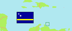
Mahaai
Geozone in Curaçao
Contents: Subdivision
The population in Mahaai as well as related information and services (Wikipedia, Google, images).
| Name | Status | Population Census 2011-03-26 | |
|---|---|---|---|
| Mahaai | Geozone | 2,776 | |
| Cas Cora | Neighborhood | 467 | → |
| Damacor | Neighborhood | 486 | → |
| Francia | Neighborhood | 419 | → |
| Jonchi | Neighborhood | 46 | → |
| Mahaai | Neighborhood | 389 | → |
| Rooi Catochi | Neighborhood | 319 | → |
| Soledad bij Francia | Neighborhood | 116 | → |
| Van Engelen | Neighborhood | 534 | → |
| Curaçao | Country | 150,563 |
Source: Central Bureau of Statistics, Netherlands Antilles (web).
Explanation: Area figures of neighborhoods are computed by using geospatial data.
Further information about the population structure:
| Gender (C 2011) | |
|---|---|
| Males | 1,223 |
| Females | 1,553 |
| Age Groups (C 2011) | |
|---|---|
| 0-14 years | 505 |
| 15-64 years | 1,699 |
| 65+ years | 572 |
| Country of Birth (C 2011) | |
|---|---|
| Curaçao | 1,639 |
| Other country | 1,117 |