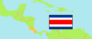
Turrialba
Canton in Costa Rica
Contents: Subdivision
The population development in Turrialba as well as related information and services (Wikipedia, Google, images).
| Name | Status | Population Estimate 2000-06-30 | Population Estimate 2011-06-30 | Population Projection 2020-06-30 | |
|---|---|---|---|---|---|
| Turrialba | Canton | 69,611 | 72,631 | 73,659 | |
| Chirripó (← La Suiza & Tayutic) | District | 3,273 | 4,369 | 4,566 | → |
| La Isabel (← Turrialba) | District | 6,504 | 6,239 | 6,361 | → |
| La Suiza | District | 6,079 | 7,947 | 7,972 | → |
| Pavones | District | 4,500 | 4,546 | 4,634 | → |
| Peralta | District | 580 | 589 | 618 | → |
| Santa Cruz | District | 3,475 | 3,563 | 3,775 | → |
| Santa Rosa | District | 4,838 | 5,527 | 5,722 | → |
| Santa Teresita | District | 5,181 | 5,133 | 5,376 | → |
| Tayutic | District | 4,523 | 2,575 | 2,530 | → |
| Tres Equis | District | 1,978 | 1,903 | 1,960 | → |
| Tuis | District | 2,675 | 3,023 | 2,974 | → |
| Turrialba | District | 26,005 | 27,217 | 27,171 | → |
| Costa Rica | Republic | 3,872,343 | 4,592,147 | 5,111,221 |
Source: Instituto Nacional de Estadística y Censos.
Further information about the population structure:
| Gender (P 2020) | |
|---|---|
| Males | 37,050 |
| Females | 36,609 |
| Age Groups (P 2020) | |
|---|---|
| 0-14 years | 15,783 |
| 15-64 years | 50,100 |
| 65+ years | 7,776 |
| Age Distribution (P 2020) | |
|---|---|
| 0-9 years | 10,629 |
| 10-19 years | 10,415 |
| 20-29 years | 11,930 |
| 30-39 years | 11,348 |
| 40-49 years | 9,165 |
| 50-59 years | 8,824 |
| 60-69 years | 6,281 |
| 70+ years | 5,067 |
| Urbanization (C 2011) | |
|---|---|
| Rural | 29,670 |
| Urban | 39,946 |
