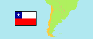
Los Andes
Province in Chile
Contents: Subdivision
The population development in Los Andes as well as related information and services (Wikipedia, Google, images).
| Name | Status | Population Estimate 2002-07-01 | Population Estimate 2007-07-01 | Population Estimate 2012-07-01 | Population Estimate 2017-07-01 | Population Projection 2023-07-01 | |
|---|---|---|---|---|---|---|---|
| Los Andes | Province | 93,947 | 99,733 | 105,925 | 111,997 | 119,516 | |
| Calle Larga | Municipality | 10,467 | 12,054 | 13,714 | 15,371 | 17,388 | → |
| Los Andes | Municipality | 61,674 | 63,146 | 64,879 | 66,572 | 68,788 | → |
| Rinconada | Municipality | 7,026 | 8,190 | 9,374 | 10,513 | 11,847 | → |
| San Esteban | Municipality | 14,780 | 16,343 | 17,958 | 19,541 | 21,493 | → |
| Chile | Republic | 15,691,701 | 16,517,933 | 17,443,491 | 18,419,192 | 19,960,889 |
Source: Instituto Nacional de Estadísticas.
Explanation: All tabulated population figures consider the results of the 2017 census.
Further information about the population structure:
| Gender (P 2023) | |
|---|---|
| Males | 58,659 |
| Females | 60,857 |
| Age Groups (P 2023) | |
|---|---|
| 0-17 years | 28,399 |
| 18-64 years | 74,129 |
| 65+ years | 16,988 |
| Age Distribution (P 2023) | |
|---|---|
| 80+ years | 3,878 |
| 70-79 years | 7,360 |
| 60-69 years | 12,364 |
| 50-59 years | 14,231 |
| 40-49 years | 16,716 |
| 30-39 years | 18,329 |
| 20-29 years | 15,570 |
| 10-19 years | 15,591 |
| 0-9 years | 15,477 |
| Urbanization (C 2017) | |
|---|---|
| Rural | 19,457 |
| Urban | 91,145 |
| Country of Birth (C 2017) | |
|---|---|
| Chile | 108,378 |
| South America | 1,848 |
| Central America & Caribbean | 124 |
| North America | 31 |
| Europe | 160 |
| Other country & undeclared | 61 |