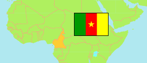
Menchum
Department in Cameroon
Contents: Subdivision
The population development in Menchum as well as related information and services (Wikipedia, Google, images).
| Name | Status | Population Census 1987-04-10 | Population Census 2005-11-11 | |
|---|---|---|---|---|
| Menchum | Department | 105,664 | 161,998 | |
| Fungom | Arrondissement | ... | 58,666 | → |
| Furu-Awa | Arrondissement | ... | 13,997 | → |
| Menchum Valley | Arrondissement | ... | 50,235 | → |
| Wum | Arrondissement | ... | 39,100 | → |
| Cameroun [Cameroon] | Republic | 10,493,655 | 17,463,836 |
Source: Bureau Central des Recensements et des Etudes de Population, Institut National de la Statistique Cameroun (web).
Explanation: Area and density figures of arrondissements are computed using geospatial data.