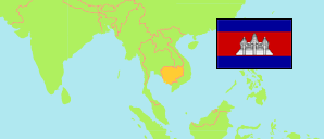
Preăh Vihéar
Province in Cambodia
Contents: Population
The population development in Preăh Vihéar as well as related information and services (Wikipedia, Google, images).
| Name | Status | Native | Population Census 1998-03-03 | Population Census 2008-03-03 | Population Census 2019-03-03 | |
|---|---|---|---|---|---|---|
| Preăh Vihéar | Province | ខេត្តព្រះវិហារ | 119,261 | 171,139 | 254,827 | |
| Kâmpŭchéa [Cambodia] | Kingdom | កម្ពុជា | 11,437,656 | 13,395,682 | 15,552,211 |
Source: National Institute of Statistics of Cambodia (web)
Explanation: The result of the 2019 census represents the de facto population of Cambodia. It excludes about 1.235 million migrants working abroad.
Further information about the population structure:
| Gender (C 2019) | |
|---|---|
| Males | 128,436 |
| Females | 126,391 |
| Age Groups (C 2019) | |
|---|---|
| 0-14 years | 85,362 |
| 15-59 years | 154,792 |
| 60+ years | 14,673 |
| Typ of Household (C 2019) | |
|---|---|
| Regular | 248,947 |
| Institutional | 4,153 |
| Boat | 3 |
| Homeless | 136 |
| Transient | 1,588 |
| Urbanization (C 2019) | |
|---|---|
| Rural | 224,587 |
| Urban | 24,360 |
| Literacy (A15+) (C 2019) | |
|---|---|
| yes | 132,952 |
| no | 36,513 |
