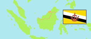
Pekan Tutong
Mukim in Tutong District
Contents: Subdivision
The population development in Pekan Tutong as well as related information and services (Wikipedia, Google, images).
| Name | Status | Population Census 2011-06-20 | Population Census 2016-05-01 | Population Census 2021-04-20 | |
|---|---|---|---|---|---|
| Pekan Tutong | Mukim | 11,144 | 10,551 | 9,883 | |
| Bukit Bendera | Quarter | 1,321 | 1,067 | 931 | → |
| Kampung Kandang | Village | 324 | 305 | 300 | → |
| Kampung Kuala Tutong | Village | 331 | 295 | 238 | → |
| Kampung Panchor Dulit | Quarter | 504 | 541 | 478 | → |
| Kampung Panchor Papan | Quarter | 371 | 483 | 358 | → |
| Kampung Penabai | Village | 849 | 888 | 749 | → |
| Kampung Penanjong | Quarter | 2,021 | 2,065 | 1,856 | → |
| Kampung Petani | Quarter | 1,328 | 997 | 1,087 | → |
| Kampung Sengkarai | Quarter | 1,847 | 1,989 | 1,694 | → |
| Kampung Serambangun | Quarter | 228 | 357 | 502 | → |
| Kampung Tanah Burok | Quarter | 423 | 465 | 477 | → |
| Paya Pekan Tutong | Area | 0 | 0 | 0 | → |
| Pulau Bakuku | Island | 0 | 0 | 0 | → |
| Pulau Salawat | Island | 0 | 0 | 0 | → |
| Tutong Kem | Quarter | 1,597 | 1,099 | 1,213 | → |
| Tutong | District | 43,852 | 48,313 | 47,210 |
Source: Department of Economic Planning and Development, Brunei (web).
Explanation: Area figures are computed by using geospatial data. Urban/rural categorization according to 2016 census.
Further information about the population structure:
| Gender (C 2021) | |
|---|---|
| Males | 5,211 |
| Females | 4,672 |
| Age Groups (C 2021) | |
|---|---|
| 0-14 years | 2,172 |
| 15-64 years | 7,035 |
| 65+ years | 676 |
| Citizenship (C 2021) | |
|---|---|
| Brunei | 7,890 |
| Permanent Resident Foreigners | 305 |
| Temporary Resident Foreigners | 1,688 |
| Urbanization (C 2021) | |
|---|---|
| Rural | 1,287 |
| Urban | 8,596 |