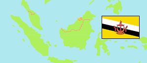
Temburong
District in Brunei
Contents: Subdivision
The population development in Temburong as well as related information and services (Wikipedia, Google, images).
| Name | Status | Population Census 2011-06-20 | Population Census 2016-05-01 | Population Census 2021-04-20 | |
|---|---|---|---|---|---|
| Temburong | District | 8,852 | 10,251 | 9,444 | |
| Amo | Mukim | 1,874 | 2,144 | 1,657 | → |
| Bangar | Mukim | 2,511 | 2,449 | 2,112 | → |
| Batu Apoi | Mukim | 1,403 | 1,635 | 1,355 | → |
| Bokok | Mukim | 2,559 | 3,433 | 3,812 | → |
| Labu | Mukim | 505 | 590 | 508 | → |
| Brunei | State | 393,372 | 417,256 | 440,715 |
Source: Department of Economic Planning and Development, Brunei (web).
Explanation: Area figures for mukims are computed using geospatial data. Urban/rural categorization according to 2016 census.
Further information about the population structure:
| Gender (C 2021) | |
|---|---|
| Males | 5,031 |
| Females | 4,413 |
| Age Groups (C 2021) | |
|---|---|
| 0-14 years | 1,966 |
| 15-64 years | 6,674 |
| 65+ years | 804 |
| Citizenship (C 2021) | |
|---|---|
| Brunei | 7,723 |
| Permanent Resident Foreigners | 907 |
| Temporary Resident Foreigners | 814 |
| Urbanization (C 2021) | |
|---|---|
| Rural | 8,993 |
| Urban | 451 |
