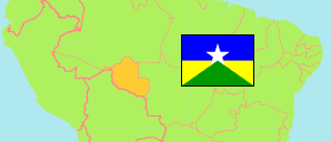
State
The population development of the State of Rondônia according to census results.
| Name | Abbr. | Status | Capital | Area A (km²) | Population Census (Cf) 1991-09-01 | Population Census (Cf) 2000-08-01 | Population Census (Cf) 2010-08-01 | Population Census (C) 2022-08-01 | |||
|---|---|---|---|---|---|---|---|---|---|---|---|
| Brazil | BRA | Fed Rep | Brasília | 8,510,418 | 146,825,475 | 169,799,170 | 190,755,799 | 203,080,756 | |||
| Rondônia | RO | FSt | Porto Velho | 237,754 | 1,132,692 | 1,379,787 | 1,562,409 | 1,581,196 | 23775400 | → |
- Instituto Brasileiro de Geografia e Estatistica.
Major Cities
| Name | Population Calculation (UE-E) 2021-07-01 | |
|---|---|---|
| 1 | Porto Velho | 500,540 |
| 2 | Ji-Paraná | 117,820 |
| 3 | Vilhena | 99,050 |
| 4 | Ariquemes | 94,140 |
| 5 | Cacoal | 68,100 |
| 6 | Rolim de Moura | 45,600 |
| 7 | Guajará-Mirim | 39,660 |
| 8 | Jaru | 34,760 |
| 9 | Pimenta Bueno | 32,270 |
Contents: Cities & Towns
The population of all cities and towns in the State of Rondônia with more than 20,000 inhabitants according to census results and latest calculations.
The urban population of the corresponding municipality is tabulated.
| Name | Population Census (Cf) 1991-09-01 | Population Census (Cf) 2000-08-01 | Population Census (Cf) 2010-08-01 | Population Calculation (UE-E) 2021-07-01 | Area | ||
|---|---|---|---|---|---|---|---|
| Ariquemes | 45,283 | 55,118 | 76,525 | 94,140 | 0 | → | |
| Buritis | ... | 15,334 | 18,122 | 22,970 | 0 | → | |
| Cacoal | 44,091 | 51,398 | 61,921 | 68,100 | 0 | → | |
| Espigão d'Oeste | 11,186 | 14,262 | 20,610 | 23,680 | 0 | → | |
| Guajará-Mirim | 27,406 | 33,035 | 35,207 | 39,660 | 0 | → | |
| Jaru | 27,675 | 29,577 | 35,118 | 34,760 | 0 | → | |
| Ji-Paraná | 75,414 | 91,013 | 104,858 | 117,820 | 0 | → | |
| Machadinho d'Oeste | 4,891 | 10,981 | 16,173 | 21,670 | 0 | → | |
| Ouro Preto do Oeste | 23,586 | 26,541 | 28,180 | 26,340 | 0 | → | |
| Pimenta Bueno | 25,505 | 26,423 | 29,417 | 32,270 | 0 | → | |
| Porto Velho | 229,788 | 273,709 | 390,733 | 500,540 | 0 | → | |
| Rolim de Moura | 28,272 | 34,421 | 41,429 | 45,600 | 0 | → | |
| Vilhena | 34,513 | 50,601 | 72,218 | 99,050 | 0 | → |
- The urban population for 2021 is calculated by »City Population« using the urban population according to the 2010 census and latest official population estimates for the total municipality.
- Instituto Brasileiro de Geografia e Estatistica.