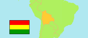
Chapare
Province in Bolivia
Contents: Population
The population development of Chapare as well as related information and services (Wikipedia, Google, images).
| Name | Status | Population Census 1992-06-03 | Population Census 2001-06-29 | Population Census 2012-11-21 | Population Census 2024-03-23 | |
|---|---|---|---|---|---|---|
| Chapare | Province | 131,727 | 187,358 | 263,137 | 333,408 | |
| Bolivia | Plurinational State | 6,420,792 | 8,274,325 | 10,027,254 | 11,312,620 |
Source: Instituto Nacional de Estadística de Bolivia.
Explanation: Census figures are not adjusted for undercount. Area figures of provinces are calculated using geospatial data.
Further information about the population structure:
| Gender (C 2012) | |
|---|---|
| Males | 132,855 |
| Females | 130,282 |
| Age Groups (C 2012) | |
|---|---|
| 0-14 years | 85,872 |
| 15-64 years | 164,852 |
| 65+ years | 12,413 |
| Age Distribution (C 2012) | |
|---|---|
| 0-9 years | 57,329 |
| 10-19 years | 59,092 |
| 20-29 years | 49,511 |
| 30-39 years | 35,309 |
| 40-49 years | 25,712 |
| 50-59 years | 17,538 |
| 60-69 years | 10,758 |
| 70-79 years | 5,211 |
| 80+ years | 2,677 |
| Urbanization (C 2012) | |
|---|---|
| Rural | 100,422 |
| Urban | 162,715 |
| Literacy (A15+) (C 2012) | |
|---|---|
| yes | 168,419 |
| no | 8,846 |
